Jharkhand government eyeing intellectual property rights for Peda and Sohrai

Source: newindianexpress.com

RANCHI: With the intention of claiming patents on Deoghar’s ‘peda’ and ‘Sohrai’ painting of Hazaribagh, the State Government has decided to conduct a research survey for guidance in establishing intellectual property rights and geographical indicators of Jharkhand, outsourcing the work to the National Law School of India in Bengaluru.

The State Cabinet on Tuesday sanctioned Rs 33.55 lakh for the purpose.

The Cabinet gave its approval for research, survey and filing application for the registration of Geographical Indication of Jharkhand and guiding in establishing intellectual property rights centre for Micro, Small and Medium Enterprises (MSME).

Officials said that the survey will be focused on MSMEs and the research will help them get intellectual property rights over products.

The MSME Centre in Ranchi will function as the nodal office for this survey. The famous Deoghar peda and Hazaribagh Sohrai art and many other products and art forms of Jharkhand may also come under this survey,” Urban Development Secretary Ajay Kumar Singh told the media on Wednesday.

Peda is offered to Lord Shiva at Deoghar. As per an estimate, annual turnover of peda is around Rs 50 crore, with a remarkable increase during Shrawani Mela.

Sohrai painting, on the other hand, is an indigenous art form practised by the women, where ritualistic art is done on mud walls to welcome the harvest season and to celebrate cattle.

Jharkhand govt committed to development of 3.25 cr people: Raghubar Das tells NITI Aayog

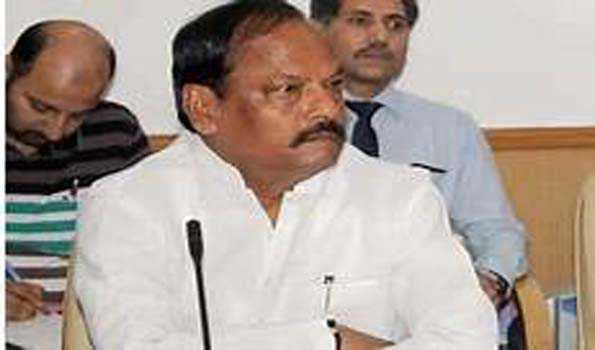
Source: moneycontrol.com

Jharkhand Chief Minister Raghubar Das said the state government is working to provide better health facility, education and infrastructure.

The state government is committed to the development of 3.25 crore people, he said at a meeting here with NITI Aayog officials.

Jharkhand has made significant progress in education and the state is continuously developing its health sector as well, an official release quoting Das said.

“Our goal is to take the state at the forefront in these sectors,” the chief minister said.

Das said that the state government and the NITI Aayog are doing good work together and the partnership would continue.

The NITI Aayog understands our expectations and cooperating in reforming our shortcomings, he said.

According to the release, the Vice Chairman of NITI Aayog, Rajiv Kumar, said that reviews were carried out on important issues during the meeting with the state government on Wednesday.Kumar praised the state for progress in education, for eradicating child marriage and doing away with malnutrition, the release said, adding, Kumar also lauded the state government’s effort to train 10 lakh women in various fields.

Bangalore Law varsity to survey intellectual property in Jharkhand

Source: dailypioneer.com

The State Cabinet on Tuesday approved a research survey for guidance in establishing intellectual property rights and geographical indication of Jharkhand for the same. The Cabinet decided to outsource this work to the National Law School of India in Bangalore for Rs 33.55 Lakh.

The survey will be focused on Micro Small and Medium Enterprises (MSME), said State Urban Development Secretary Ajoy Kumar Singh, adding that the research will help small enterprises get intellectual property rights over their products. The MSME centre in Ranchi will function as the nodal office for this survey. “Deoghar’s peda (an Indian sweet), Sohrai art of Hazaribag and many other products and art forms of Jharkhand may come under this survey,” said Singh.

The Cabinet on Tuesday approved a total of 20 proposals, including a pilot project for introduction of artificial intelligence in the functioning of the Jharkhand High Court. A private company, Mancorp Innovation Labs Private Ltd has been outsourced the work of ensuring design, development, implementation and support of artificial intelligence in the court in a bid to make Jharkhand High Court a Comprehensive Decision Support Smart Court (CDSSC). “The software will rely on artificial intelligence for collecting data and finding order copies in the court,” said Singh.

In another move towards digitalization, the Cabinet approved Rs.66,33,000 for digitalization of the Principal Accountant General’s office in Ranchi.

The Cabinet on Tuesday also came up with good news for State government employees. It approved an increase in dearness allowance from 9 per cent to 12 per cent with effect from January 1, 2019 for all the state employees and pensioners. This will cost the state exchequer a sum of Rs.364 crore for working employees and Rs.161 crore for pensioners. This increase in dearness allowance was earlier approved by the centre and replicated by the cabinet on Wednesday.

Following an order of the Supreme Court, the Cabinet on Wednesday approved the formation of a tribunal to look into the claims made by survivors or family of deceased in cases of road accidents. Besides, the Cabinet approved creation of 279 vacancies for teachers in eight polytechnic colleges and surrender of 145 such posts. For the creation of the 134 new posts, the state will bear a cost of Rs.5 crore 53 lakh annually. The new positions will be created in Simdega, Sahebganj, Jagganathpur and Dumka, while positions will be surrendered in Chandil, Bahragora and Maheshpur.

The Cabinet proposed to give Jharkhand Combined Entrance Competitive Examination (JCEC) the authority to hold B.Ed exams and all other examinations on Optical Mark Recognition (OMR) sheets. This proposal will go to the State Assembly for approval. The JCEC holds entrance examinations for medical and engineering in Jharkhand. Besides, the Cabinet decided to forward an annual report of Jharkhand Public Service Commission for year 2016-2017 to the State Assembly.

Ranchi forest cover increased by 0.86%: Report

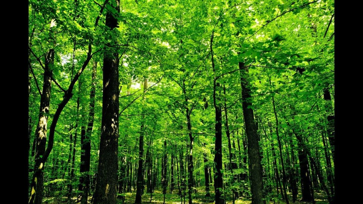
Source: dailypioneer.com

While the temperature in Capital city is touching 42 degree Celsius, a government report on forest area in Ranchi division shows an increase in the forest cover.

According to the latest Indian State of Forest Report (ISFR) published by Forest Survey of India in 2018, Ranchi increased its forest area by 10 sq km since 2015, the highest increase among all the districts in Jharkhand. This increase happened despite rapid urbanisation and development in the city. The Pioneer contacted environmentalists and government officials on the issue ahead of World Environment Day.

“As the data shows, the city’s forest area has increased in the last few years. It is the result of a targeted approach of the Ranchi Forest Division, where we have different management policies for different kinds of forests,” said Sushil Oraon, Assistant Conservator of Forest, Ranchi Forest Division. As per the report, Ranchi currently has 63 sq. km of ‘Very Dense Forest’, 364 sq. km of ‘Moderately Dense Forest’, and 737 sq. km of ‘Open Forest’.

“We focus on the maintenance and improvement of dense forests, and try to increase density of the moderately dense forests so that they are promoted to the dense forest category. For open forests, we push for afforestation, so that the overall forest cover increases,” Oraon said. He said that the Pollution Board is organising an event on Wednesday to mark World Environment Day.

An initiative was undertaken recently by the Ranchi Smart City Corporation (RSCC) along with Jharkhand Urban Infrastructure Development Company Limited (JUIDCO) and Larson and Toubro (L&T) on Sunday, where officials from the three companies planted a lot of saplings to compensate for the various ongoing projects across the State.

However, environmentalists have continued to show concern over the matter. Environmentalist Nitish Priyadarshi raised the issue of the environmental concerns of the loss of trees due to rapid construction work in the city.

He also stressed on the impossibility of recovering lost forests. “We cannot create forests. We can plant trees, but forests are natural that develop over a long period of time,” he said. “Also, planting trees is easy, but protecting and caring for them requires commitment. Instead of just planting trees and forgetting about it, the government should have a long term policy, so that the planted trees are cared for when they begin to grow in two three years. Planting trees is just a formality if the there is no follow-up,” he added.

Priyadarshi, who teaches Geology at Ranchi University, dismissed the government data and pointed out the evident ill-effects of deforestation. “The increase in temperature, the water crisis, the man-animal conflicts in neighbouring areas are all results of this increasing loss of forests.” He suggested many ways to combat the problem. “Public awareness, strict government policy, cultivation of barren land are all beneficial steps,” he said. “We can also follow the example of the sacred forests of Meghalaya, where nothing is allowed to leave the forest groves due to the religious beliefs of the indigenous cultures.”


Land Issues – JMM youth wing leader shot in Bokaro

BOKARO: Four motorbike-borne miscreants shot dead Amit Manjhi, district president of the Jharkhand Chatra Yuva Morcha (JCYM), students wing of the Jharkhand Mukti Morcha (JMM), while he was on his way to residence at Adarsh Cooperative under Sector-XII police station here on Saturday night. Land dispute with local builders is said to be the reason behind his murder.

Police have arrested three accused whom the kin of the deceased have named in the FIR soon after his murder. The incident has sparked off protest among JMM workers, who assembled at the Bokaro General Hospital (BGH) in large numbers and raised anti-slogans against district police demanding arrest of the murderers soon.

JMM leaders, including Basant Soren, youngest son of party chief Shibu Soren, and the state president of JCYM, Dumri MLA Jagarnath Mahto have given a 24-hour ultimatum to the district police officials to solve the case and arrest criminals or else the party workers will launch an agitation.

Based on the complaint lodged by elder brother of the deceased, Karamchand Manjhi, police have arrested Manoj Pandey, Virender Yadav and Pinto Singh alias Druv Kumar Singh from their homes. Pinto is a resident of Sector-VI, Yadav resides in Chas and Pandey is from Sector-XII. “We are interrogating the trio – all involbed in land business – to bring the truth. A few days ago, they have entered in an altercation with Manjhi because he was opposing them from leveling lands at Satanpur,” he said.

According to sources, the incident occurred on Saturday night when Manjhi was riding his motorbike on his way back home. The miscreants opened fire on his running motorbike following which he fell down. Manjhi struggled to escape but criminals again shot him dead. The local police reached the spot after residents informed them about the gun firing and recovered Manjhi’s body lying in a pool of blood around 300 meters from his motorbike near Adarsh Cooperative.

Police also found two country-made pistols along with two used cartridges from the spot. Criminals have shot four bullets on his head, hand and back side. Manjhi, son of a retired Bokaro Steel Ltd employee, was a resident of Bharat Ekta Cooperative. Before the incident, he had food at a makeshift shop with his father Jaleshwar Manjhi and mother in Sector XII/C Shopping Center. Later, he went alone saying that he will reach home soon.

Karamchand said two days ago, Pinto had called him on his phone and told him to stop Manjhi from interfering their business or it will be bad for him. However, a month ago Virender and Manjhi also had a fight over a land issue of which FIR has been lodged with the police station. “These builders were leveling a land which is worship place of tribal and Manjhi has stopped them doing so. This has developed enmity against Manjhi for them,” said Karmchand.

Basant Soren said, “The incident is very unfortunate. Manjhi was a good student leader and helped poors and so he has been targeted by land mafias. “The JMM has taken the incident very seriously and we will not remain quiet until each of the criminals will be sent behind bars,” he said. Bokaro SP Kuldeep Dwivedi said it was a planned murder following a land dispute. Police have arrested three accused and raids are on to nab other absconding person.

Probe reports point to land loot in Bokaro

  1. Bari cooperative colony,
  2. Manmohan Singh cooperative,
  3. Adarsh cooperative,
  4. Sattan hillocks,
  5. Chira Chas, Chas,
  6. Jogidih colony and
  7. Kuer Singh colony

The spectre of a land scam has raised its head in Bokaro with outgoing deputy commissioner Amitabh Kaushal saying that non-transferable land in various areas might have been sold off illegally by government officials.

This comes at a time a multi-crore scam involving 800 acres of non-transferable state and private land has rocked Deoghar.

In August, Kaushal had ordered an inquiry after laying hands on incriminating documents that suggest illegal sale of at least 20 acres at Bari cooperative colony, Manmohan Singh cooperative, Adarsh cooperative, Sattan hillocks, Chira Chas, Chas, Jogidih and Kuer Singh colony. The DC had formed a team, comprising deputy collectors and Chas (Bokaro) SDO Sudhir Ranjan, to conduct preliminary investigations.

The team inspected the sites under scanner and detected irregularities in allotment of land, including gair majrua, tribal land and forestland. They found out that even the Garga riverbed has been encroached upon.

“A massive land loot cannot be ruled out in Bokaro. But I do not want to take any measure in haste. Rather, all documents of the disputed land must be studied thoroughly first. If foul play is detected, an eviction drive will be carried out and the plots handed over to their rightful owners,” Kaushal, who has been transferred to Ramgarh as DC, said.

“But as I have been transferred, the ball will be now in the new deputy commissioner’s court,” he added.

Asked whether his transfer had anything to do with exposure of the land scam, the DC said: “No comments. It’s the prerogative of the government.”

Incidentally, the land controversy at Bari cooperative and nearby areas first broke in 2005-06 during the tenure of former deputy commissioner Amrendra Partap Singh (now industries secretary). Singh had also ordered an inquiry, but the matter was swept under the carpet soon after his transfer. Reports of illegal land dealings have also come from another posh locality, Lohanchal cooperative, prompting the deputy commissioner to stop the ongoing registration process of land there.

Beware of land scammers: Bokaro DC

BOKARO: Taking a note of a steep rise in incidents of land scams that dupe many people, Bokaro deputy commissioner Uma Shanker Singh on Wednesday urged the residents to verify land-related documents from the government office concerned before buying flats or houses from builders and real estate agents.
TNN | Feb 20, 2014, 10.07AM IST

Singh made this appeal after a fresh case of land scam was busted in an inquiry constituted by him. A builder launching housing project named Golden City in Chas block has allegedly duped more than 100 people for a sum of about Rs 3 crore. The company had purchased 71 acres of land, but sold a chunk of more than 10 acres on the basis of fake documents.

After receiving complaints from the residents, Singh constituted an inquiry headed by Chas circle officer Naresh Soni and special officer Krishna Kumar. They found that the builder has fraudulently sold land to the residents showing fake sale deed and agreements. Singh said that a notice was sent to the builders asking them to present documents before the officials, but they failed to appear before the panel. However, when residents started demanding their money back, the builder threatened them with dire consequences.

The accused have been identified as Sushil Kumar Singh, Sunil Kumar, Sudhir Kumar, Anil Kumar and five others. “Based on the report, I have directed the officials to take strict legal action against the accused. We have also asked the police to take necessary measures to ensure that those cheated by the builder get their money back,” said Singh. He also urged the people of the district to “verify land status before purchasing flats or bungalows from builders or middlemen. Do not keep your eyes closed while buying houses as it will make you suffer”

Bokaro has witnessed many lands scam cases in which builders first acquire lands in an unauthorized manner and then sell it to residents. Singh also warned builders to not to indulge in such unfair practices because they are not being spared if caught someday. Rising population and rapid industrialization has inflated land prices and boosted the real estate business here.

Betla National Park

Betla National Park-Jharkhand
About:
Situated in the district of Daltonganj, Palamau Sanctuary is spread over an area of 979sq.km. The core area of 232 sq. kms of the sanctuary was declared as Betla National park in September1989. The park occupies the western parts of the Chotanagpur plateau and was constituted in the year 1960 as an extension of the Hazaribagh National park. Palamau has the distinction of being the forest where the world’s first tiger census was enumerated in 1932. The park became one of the earliest 9 tiger reserves in India under ‘Project Tiger’ in 1974.  

The forests of the park have a vast range of vegetation consisting of tropical wet evergreen forests in the lower reaches, mixed (moist & dry) deciduous forests in the middle and temperate alpine forests in the upper reaches including Sal and bamboo as the major components along with a number of medicinal plants. The river Koel and its tributaries run through the northern portion of the park. There are grasslands in the river flowing area. It has waterfalls and hot springs too. Once the seat of Chero kings, there are two historical forts, one of them belonging to the 16th century deep inside the forest. The main sentinel of the old fort is visible high up on the hill with defences in three directions and three main gates.

The diversity of eco-system promotes a wide variety of fauna consisting of elephant, panther, leopard, wild boar, tiger, gaur, sloth bear, sambar, chital, nuntjac, nilgai, langur, mouse deer, monkeys, small Indian civet, mongoose, jackals, porcupine, ant eating pangolin etc. Elephants in large numbers are seen mostly during the monsoons up to the time when water sources begin to dry up in March. Jackal and hyena are common scavengers. Bird-life is rich featuring the hornbill, peafowl, red jungle fowl, black partridge, white necked stork, black ibis, swamp grey, quail, the pied born bill, wagtails, the harial, doves, drongo, the crested serpent-eagle, forest owls, the papiha and other birds usually found in dry deciduous forests. The famous Kamaldah lake attracts several varieties of water birds including the common whistling and cotton teal, the comb duck, snipe and geese. The rhesus monkey and the common languor provide attraction to children visiting the park.
Location info:
Address:Daltonganj,Ranchi,Jarkhand,India
District: Daltonganj
Nearest City: Daltonganj
Best time to visit: October to May
Climate/Weather:
The climate of this region is extreme with the maximum temperature going well over 40°C in summers. In total contrast to this, winters are quite cold with the minimum temperature dipping to 3°C. The monsoon months are from July to mid September.
History:
Betla national park is nestled in the lap of Deccan Plateau which includes 1,026 km² of Palamau Tiger Reserve in the state of Jharkhand. An additional 226 km² was added to the park in 1989 and 63 km² of the Mahuadar wolf sanctuary was added to national park.
Interesting things to do:
Visit the historical monuments that the national park houses. Purana Quila and Naya Quila are important attractions for tourists. Though they are named the Old Fort and the New Fort, they seem to be built around the same time.Enjoy stunning views from the watchtowers and the ground hides that have been recently added to enhance the charm of wildlife spotting in the park.Other attractions that one must visit here include waterfalls and hot springs.Elephant rides into the jungle of Betla are a major draw for tourists visiting here.
Interesting things to Visit:
Fauna:
Large herds of Gaur and Chital are commonly seen. Elephants are present mostly after the monsoons up to the time when water holes begin to dry up in March. Tiger, Panther, Sloth Bear, Wild Bear, Sambhar, Nilgai, Kakar, Mouse Deer are also permanent residents. Large families of langurs are an ever present attraction. Palamu is now one of the nine Tiger Reserves in India under Project Tiger
Mobile range info:
 
How to reach?
Nearest Railway Station:Daltonganj (25 km away) Railway Station
Nearest Airport:Ranchi, situated around 140 km away, is the airport with regular air connections to Delhi, Calcutta, Patna and Lucknow.
Road Transport: Betla is well connected to Daltonganj (25 kms) via Khudia morh (6km), Ranchi (140 kms), Hazaribagh (190 kms), Netarhat (211 kms), Patna (384 kms), Calcutta (575 kms) etc by regular buses run by the state transport corporation and private companies.  
Nearest Visiting places:
Shahpur:
Opposite Daltonganj on the west bank of the Koel is the village SHAHPUR in which Gopal Rai, the Raja of Palamu built a palace in the end of the 18th century. Shahpur stands on a high tract of land and the ruined place, the white temple and the masonry building present a picturesque view from Daltonganj. A nearer view of the palace is disappointing for what looks in the distance like an imposing edifice is seen to be half- finished building of little architectural importance.  

Palamau:
Palamau on the Auranga river , 20 miles south-east of Daltonganj as the crow flies, from which the district takes its name is for historian and archaeologist the most interesting place in the district, for it was for many years the seat of the Chero chiefs and it contains the ruins of the two great forts built by them, the capture of which by Mughals and later by the British resulted in the collapse of the Chero resistance, the forts lie within the reserved forests and in order to preserve them the jungle has to be cut back at intervals .they are a favourite haunt of tigers, whose pug marks may nearly always be seen in and around the fort.The walls which are in preservation are about 5 feet in thickness and those of the old fort bear marks of cannon balls and bullets in many places.

Netarhat:
The plateau of Netarhat in Palamu district is comparatively unknown to the tourists from outside although it is one of the rare beauty spots which is capable of great development. About a century back, it is understood, there was a military camp at Netarhat. The camp had to close down because sufficient good water was not available. It was left to Sir Edward Gait, Lt. Governor of Bihar and Orissa to give a great Importance to the plateau. Sir Edward and after him many of the Bihar and Orissa and later Bihar Governors use to spend a part of the summer exodus at Netarhat . Netarhat although situated in Palamau District is more easily accessible from Ranchi, the summer head quarter of the Old Bihar Govt. it is at a distance of 96 miles from Ranchi, the last 12 miles of which commencing from Banari runs through the hilly section and is typical of any of the other hill stations. There is an excellent all weather road of morum which is capable of widening at some places. The cars can pass conveniently.
plateau:
A plateau, four miles long and two and a half miles broad. It is in the extreme of the district, the highest point of which is 3,800 feet above the sea level. It is in Mahuadanr police station and is 96 miles west of Ranchi across seven hills. This is the highest point on the plateau of Chhotanagpur. Netarhat is a place of peculiar charm which has a laid its spell on many casual visitors. The stillness of the jungle and the cool and refreshing air brings relief from the dust and heat of the plains. Netarhat has a game sanctuary amidst pine forest the bestow singular arboreal interest in this part. Some time back it used to be the permanent summer station of the Governor.

Palamau National Park:
Palamau is one of the popular national parks of India. Palamau is situated within the lndo-Malayan realm and is rich in flora and fauna, though the area is prone to severe droughts. There are 107 villages in the buffer area and three in the core with a human population of 65,000 and a livestock population of 45,000. The core is distributed into two parts, the actual core and the recently inducted ‘satellite core’. The park was brought under Project Tiger in 1973 and is among the first nine Tiger Reserves of the country. The core area was declared a National Park in September 1989.

Hazaribagh:
The Hazaribagh National Park is one of the most significant wildlife sanctuaries in Jharkhand. The sanctuary is located at a height of about 615 meters on a low-altitude hilly region of the state. The Hazaribagh National Park in Jharkhand spans across a huge region.This national park covers a total area of 184 square kms. The Hazaribagh National Park has a tropical type of climate, where it is quite cold during winter and quite hot during summer.
Nearest Petrol Pump:
Ambalal Patel Petrol Pump:GARHWA,Jharkhand,India,ph:06561 222270
Hotels/Lodge/Accommodation:
Hotel Van Vihar:Betla,Palamu,Jharkhand,india
Things to carry:
 
Tips & Suggestions:
 
Help Line/Phone Number:
Police Station:100
Nearest Hospital:Government Hospital:Garhwa,Jharkhand,India
Society/Community Phone Number:
Link:

Hazaribagh National Park

Hazaribagh National Park-Jharkhand
About:
The Hazaribagh National Park is one of the most significant wildlife sanctuaries in Jharkhand. The sanctuary is located at a height of about 615 meters on a low-altitude hilly region of the state. The Hazaribagh National Park in Jharkhand spans across a huge region. This national park covers a total area of 184 square kms. The Hazaribagh National Park has a tropical type of climate, where it is quite cold during winter and quite hot during summer.  

The Hazaribagh National Park at Jharkhand offers a variety of vegetation starting from low-altitude stretches of grassland to thick tropical vegetations. The wildlife sanctuary of Hazaribagh National Park has a wide range of topography from low-lying regions to high hills and rolling regions.

The Hazaribagh National Park has abundant wild animals like the Chital, Nilgai, Panther, Sambar, Sloth Bear, Tiger and Wild Boar. The Cheetal, Kakar, Nilgai, Sambar and Wild Boar are among the most easily and often spotted animals particularly near the waterholes at the time of the dusk. The population of the tigers is very less. According to 1991 Census, there were 14 tigers in the park. The tigers are really difficult to sight.

A 111-km long stretch of the road in the sanctuary takes the tourists to the remotest corners and masonry towers of the park. The road, strategically laid down, offers excellent opportunities for the view of the wild animals. The tribal population also lives around the sanctuary. The ark has many watchtowers that act as the perfect hideouts to see the wildlife in its natural surroundings.
Location info:
Address:Hazaribagh National Park, Koderma,Jarkhanad,India
District: Koderma
Nearest City: Koderma
Best time to visit: October to March
Climate/Weather:
The climate in this region is tropical with hot summers and cold winters. Temperature during the summer months touch a high of 41.1’C and a low of 19.4’C. Winter months are better and the temperature ranges between a maximum and minimum of 19.4’C and 7’C. The monsoon months are July to mid-September.
History:
Eversince the Hazaribagh National Park was developed in 1954, it was known by that name but when the formal listings of the national parks was made by the United Nations, it was not included in it.On 24th June 2007, Deputy Chief Minister of Jharkhand announced that soon Hazaribagh will have an state-of-the-art Elephant Park, if this project materialize it would attract more tourist.
Interesting things to do:
Put off all music and cut off all sound. Don’t frighten animals away. Leave the animals to themselves and just watch them from a distance. Also, put your vehicles light dim because too much may frighten the animals.
Interesting things to Visit:
Fauna:
Sambhar, nilgai, chital and kakar can be seen at dusk and dawn, enjoying at water holes. Sloth bear might be encountered unexpectedly. It is a matter of chance that one sees a tiger or a panther. The last time a Tiger was sighted in the vicinity of the Forest Rest House was in 2006, as reported by the caretaker when the Tiger had killed a prey. I was very lucy to watch a Tiger from a distance of barely 30 feets while on foot; But that was way back in 1989. I still cherish the memory.  

Landscape:
The national park is located on the Chotanagpur plateau. It stretches over 184 sq km of undulating countryside, steep hills and deep drainage channels with thick tropical forests and grass meadows, at an average altitude of 615 meters. There are small rivers and a number of dams have been constructed to form artificial lakes within the park.

Hazaribagh Lake:
The Hazaribagh lake also attracts various tourists. It is a popular picnic spot and place for water sports.

Jilaiya Dam:
This dam, situated across Barakar River is a preferred attraction for the tourists. It is 55 kms away from Hazaribagh. The main road from Bath, on C.T Road passes through the reservoir and the hillock offers a breath-taking sight.

Hazaribagh Hill:
Hazaribagh is the famous hill resort to relax and enjoy the natural scenery. Hazaribagh literally means the land of thousand gardens and is situated at an altitude of 2019 feet above the sea level and set amidst hilly and forests on the opposite side of the Damodar Valley. It has excellent climate and scenic beauties all around it in the midst of dense forest which is quite rich in flora and fauna. Hazaribagh is well known for the Hazaribagh Wildlife Sanctuary. This place attracts tourists from all over the world who come here to visit the sanctuary, waterfalls and dams located in the vicinity. The best season to visit Hazaribagh is from October to April.
Mobile range info:
 
How to reach?
Nearest Railway Station: Koderma railway station , which is 59 km away, or alternately one can approach the park from the Hazaribagh Road railway station (67 km) on the Howrah-Delhi Grand Chord line.
Nearest Airport:Ranchi (91 km) ariport is connected with Calcutta, Patna, Lucknow and Delhi by regular Indian Airlines flights.
Road Transport: Hazaribagh town is connected by road to Ranchi 91 km, Dhanbad 128 km, Gaya 130 km, Patna 235 km, Daltongunj 198 km, and Calcutta (via Asansol-Govindapur-Barhi) 434 km. The Hazaribagh National Park is 19 km from the Hazaribagh town. Regular bus services connect the town with Koderma, Hazaribagh Road railway station, Patna, Gaya, Ranchi, Dhanbad, Daltongunj and other nearby places.Unmetered Taxis, Auto Rickshaws, Cycle Rickshaws and Taxis are available for the park from the Hazaribagh town. The approximate charge for a taxi is Rs. 160 for a two-way journey.
Nearest Visiting places:
Rajarappa Waterfalls:
Rajarappa Waterfalls is situated about 89 km. from Hazaribagh. The Rajarappa Waterfalls is believed to be one of the 51 sacred sites where a part of the body of Sati, the spouse of Lord Shiva fell. In this falls, the Bhera river joins the Damodar river from a height of 20 feet. A temple dedicated to Devi Chinnamasta is situated on the top of the hill. The little waterfall also offers boating facilities which introduces some very spectacular rock formations in this area.  

Tilaiya Dam:
Tilaiya Dam is a small dam that is situated on the Patna-Ranchi road and 55 kms from Hazaribagh. This dam produces only 4000 kw. of power. This was the first dam and hydro-electric power station that was built by the Damodar Valley Corporation for controlling floods across Barakar river in Hazaribagh district. It is 1,200 ft. long and 99 ft. high. It is situated in an ideal surrounding with a reservoir stretching in 36 sq. kms. This dam is mainly visited for its picturesque setting with its hills and reservoir with motor boats, swimming, terrace gardens and deer park.

Canary Hills:
The Canary Hills is located close to the town. The Canary Hills has a well laid out park and studded with three small lakes and an observation tower. From the top of the hill one can have a panoramic view of the town.

Parshnath Temple:
Parshnath Temple is situated at the top of the Parshnath Hill, the highest hill in the Giridih district in Bihar. It is situated about 200 km. from Pawapuri and 8 km. from Giridh. The path to the hill top passes through the Madhuban village from where it is an 11 km. trek. It takes almost a full day to reach the Parshnath Hill and to the temple and to come back. The Parshnath Hill is a famous abode for Jains as about 23 out of 24 Tirthankaras (including Parsvantha) are believed to have attained salvation in the Sammetasikhara of the Parshnath hills. The Parshnath hill is named after the 23rd Tirthankar Parsvanatha and rises steep above the plains of Dhanbad to a height of 1,365 metres. The Prasvantha, 23rd Tirthankar was very popular among tribal population of Chotanagpur. He is identified by the snake king Dharanendra, whose many hoods protect the meditating Tirthankar. Both the Swetamber and Digamber Jains have many beautiful temples here on the hills.

Shahpur:
Opposite Daltonganj on the west bank of the Koel is the village SHAHPUR in which Gopal Rai, the Raja of Palamu built a palace in the end of the 18th century. Shahpur stands on a high tract of land and the ruined place, the white temple and the masonry building present a picturesque view from Daltonganj. A nearer view of the palace is disappointing for what looks in the distance like an imposing edifice is seen to be half-finished building of little architectural importance.

Palamau:
Palamau on the Auranga river , 20 miles south-east of Daltonganj as the crow flies, from which the district takes its name is for historian and archaeologist the most interesting place in the district, for it was for many years the seat of the Chero chiefs and it contains the ruins of the two great forts built by them, the capture of which by Mughals and later by the British resulted in the collapse of the Chero resistance, the forts lie within the reserved forests and in order to preserve them the jungle has to be cut back at intervals .they are a favourite haunt of tigers, whose pug marks may nearly always be seen in and around the fort.The walls which are in preservation are about 5 feet in thickness and those of the old fort bear marks of cannon balls and bullets in many places.

Netarhat:
The plateau of Netarhat in Palamu district is comparatively unknown to the tourists from outside although it is one of the rare beauty spots which is capable of great development. About a century back, it is understood, there was a military camp at Netarhat. The camp had to close down because sufficient good water was not available. It was left to Sir Edward Gait, Lt. Governor of Bihar and Orissa to give a great Importance to the plateau. Sir Edward and after him many of the Bihar and Orissa and later Bihar Governors use to spend a part of the summer exodus at Netarhat. Netarhat although situated in Palamau District is more easily accessible from Ranchi, the summer headquarter of the Old Bihar Govt. it is at a distance of 96 miles from Ranchi, the last 12 miles of which commencing from Banari runs through the hilly section and is typical of any of the other hill stations. There is an excellent all-weather road of morum which is capable of widening at some places. The cars can pass conveniently.
plateau:
A plateau, four miles long and two and a half miles broad. It is in the extreme of the district, the highest point of which is 3,800 feet above the sea level. It is in Mahuadanr police station and is 96 miles west of Ranchi across seven hills. This is the highest point on the plateau of Chhotanagpur. Netarhat is a place of peculiar charm which has a laid its spell on many casual visitors. The stillness of the jungle and the cool and refreshing air brings relief from the dust and heat of the plains. Netarhat has a game sanctuary amidst pine forest the bestow singular arboreal interest in this part. Some time back it used to be the permanent summer station of the Governor.

Palamau National Park:
Palamau is one of the popular national parks of India. Palamau is situated within the lndo-Malayan realm and is rich in flora and fauna, though the area is prone to severe droughts. There are 107 villages in the buffer area and three in the core with a human population of 65,000 and a livestock population of 45,000. The core is distributed into two parts, the actual core and the recently inducted ‘satellite core’. The park was brought under Project Tiger in 1973 and is among the first nine Tiger Reserves of the country. The core area was declared a National Park in September 1989.

Betla National Park:
Situated in the district of Daltonganj, Palamau Sanctuary is spread over an area of 979sq.km. The core area of 232 sq. kms of the sanctuary was declared as Betla National park in September1989. The park occupies the western parts of the Chotanagpur plateau and was constituted in the year 1960 as an extension of the Hazaribagh National park. Palamau has the distinction of being the forest where the world’s first tiger census was enumerated in 1932. The park became one of the earliest 9 tiger reserves in India under ‘Project Tiger’ in 1974.
Nearest Petrol Pump:
Lakshmi petrol pump:NH 100,Hazaribagh,Jharkhand,India  
Koltex petrol pump:NH 100,Hazaribagh,Jharkhand,India
Ramnagar Petrol pump:Road No 4,Hazaribag,Jharkhand,India
Hotels/Lodge/Accommodation:
Lotus Nikko Bodhgaya Hotel:Bodhgaya,Gaya,Bihar,India  
Hotels Bodh Gaya:Bodhgaya,Gaya,Bihar,India
Things to carry:
 
Tips & Suggestions:
 
Help Line/Phone Number:
Police Station:100
Nearest Hospital:
Holy Family HospitalL::Koderma,Jharkhand,India
Sadar Hospital Hazaribagh:NH 100,Hazaribag,Jharkhand,India
Society/Community Phone Number:
Link:

MAITHAN DAM

MAITHAN DAM
About:
They are Maithan and Tilayia dams. Maithon dam is a very famous tourist spot because of its exquisite locale and tranquil ambiance. It is built on Barakar at a place known Maithon in the Dhanbad district while Tilayia is a dam in the Hazaribagh district. Its there in the history of Barakar river as well as in the present also that it creates huge havoc during monsoons in the upper reaches by bringing massive floods. The fury can be estimated from the fact that not once but twice it drowned two bridges constructed successively on the Grand Trunk Road that passes through it.Maithan means ‘Mother’s Home’. This dam, 15,712 ft long and 165 ft high, is built over the Barakar River and has been designed for flood control.  

The Maithon reservoir lake, spread over an area of 65 sq.km, offers boating and fishing facilities to tourists. There is also a rest house on an island in the middle of the lake. A deer park and bird sanctuary can be visited nearby. Maithon Dam has a unique underground power station which is the first of its kind in the whole of South East Asia. Visiting the power station requires prior permission. Maithan Dam, It is 52 km from Dhanbad. Maithon can also be translated as “Mother’s Abode”. Maithon has the biggest reservoir in the Damodar Valley Corporation. This dam, designed for flood control, has been built on the Barakar river. It has a unique underground power station which is first of its kind in S.E. Asia. Just a little away from the dam lies an ancient temple at Kalyaneshwari.

The lake at Maithon is spread over an area of 65 sq.kms. On an island in the lake is a rest house which offers accommodation. Boating and fishing facilities are available. Close by, a deer park and a bird sanctuary have been established. The name Maithon literally means mother`s abode. Situated on the banks of the Damodar River, the major attraction of the town is a lake. The lake covers an area of 65 sq km. and offers boating and fishing facilities.

Near the lake there is a bird sanctuary and a deer park. The Maithon Dam constructed on the Barakar River is another prime attraction for visitors. The Maithon dam was built with the objective to control floods. It also has an underground power station, which is the only one in South East Asia. A few kilometers from the Dam there is an ancient temple named Awake Temple at Kalyaneswari.
Location info:
Address:Maithan Dam,Dhanbad,Jarkhand,India
District:Dhanbad
Nearest City:Hazaribagh
Best time to visit: October to March
Climate/Weather:
Summers 16°- 41°C. Winters 1°-28°C
History:
Literally meaning Mother’s Abode, it is the biggest reservoir of the Damodar Valley Corporation (DVC). This dam, designed for flood control, has been built on the Barakar river. It has a unique underground power station which is first of its kind in SE Asia. Just a little away from the dam lies an ancient temple at Kalyaneshwari. The lake at Maithon is spread over an area of 65 sq. km. There is a rest house on an island in the lake. Boating and fishing facilities are available. Close by, a Deer Park and a bird sanctuary are also situated.
Interesting things to do:
 
Interesting things to Visit:
Dam :
The Maithon Dam, located 48 kms from Dhanbad, is 15,712 ft long and 165 ft. high. This dam specially designed for flood control generates 60000-k Watt of electricity. The unique feature that sets it apart from the rest is that there is an underground power station, first of its kind, in whole of SouthEast Asia. The dam is constructed on the Barakar River.Prior permission is required for visiting the powerhouse. The permits are issued from the office of the Assistant Public Relations Officer and guide services are also made available.  

Barakar river:
The whole catchment area of Barakar River at Jharkhand is 6159 square kilometers. The two main tributaries of Barakar River in Jharkhand are Barsoti and Usri which flow in the direction of south to north. The Barakar River flows across the districts of Hazaribagh, Dhanbad and Giridih at Jharkhand. Another fact about Barakar River at Jharkhand is that it has two dams standing over it. The main tourist attraction at the banks of Barakar in Jharkhand is the Parashnath Hill at an altitude of 4470 feet in the Giridih district of Jharkhand. Another tourist attraction near Barakar River is the pilgrimage of the Jains named Bhagvan Mahavir Swami Jain Teerth.

Jilaiya Dam:
This dam, situated across Barakar River is a preferred attraction for the tourists. It is 55 kms away from Hazaribagh. The main road from Bath, on C.T Road passes through the reservoir and the hillock offers a breath-taking sight.
Hazaribagh Hill:
Hazaribagh is the famous hill resort to relax and enjoy the natural scenery. Hazaribagh literally means the land of thousand gardens and is situated at an altitude of 2019 feet above the sea level and set amidst hilly and forests on the opposite side of the Damodar Valley. It has excellent climate and scenic beauties all around it in the midst of dense forest which is quite rich in flora and fauna. Hazaribagh is well known for the Hazaribagh Wildlife Sanctuary. This place attracts tourists from all over the world who come here to visit the sanctuary, waterfalls and dams located in the vicinity. The best season to visit Hazaribagh is from October to April.
Mobile range info:
 
How to reach?
Nearest Railway Station: Dhandad railway station is an important railhead on Eastern Railway. Several express and super-fast trains ply to Dhanbad from Patna, Kolkata, Delhi and other important cities of India.
Nearest Airport:Ranchi aiport at (175km) and Patna airport at(325 km)
Road Transport:Good network of roads connect Dhanbad with important town in Jharkhand and Bihar. Buses are available from Dhanbad to Bokaro (84 km), Ranchi (169 km) and other places of Jharkhand. Chartered buses or taxis are arranged to Dhanbad from Ranchi and Patna by Bihar State Tourism Development Corporation at regular intervals.
Nearest Visiting places:
Rajarappa Waterfalls:
Rajarappa Waterfalls is situated about 89 km. from Hazaribagh. The Rajarappa Waterfalls is believed to be one of the 51 sacred sites where a part of the body of Sati, the spouse of Lord Shiva fell. In this falls, the Bhera river joins the Damodar river from a height of 20 feet. A temple dedicated to Devi Chinnamasta is situated on the top of the hill. The little waterfall also offers boating facilities which introduces some very spectacular rock formations in this area.

Tilaiya Dam:
Tilaiya Dam is a small dam that is situated on the Patna-Ranchi road and 55 kms from Hazaribagh. This dam produces only 4000 kw. of power. This was the first dam and hydro-electric power station that was built by the Damodar Valley Corporation for controlling floods across Barakar river in Hazaribagh district. It is 1,200 ft. long and 99 ft. high. It is situated in an ideal surrounding with a reservoir stretching in 36 sq. kms. This dam is mainly visited for its picturesque setting with its hills and reservoir with motor boats, swimming, terrace gardens and deer park.

Canary Hills:
The Canary Hills is located close to the town. The Canary Hills has a well laid out park and studded with three small lakes and an observation tower. From the top of the hill one can have a panoramic view of the town.

Parshnath Temple:
Parshnath Temple is situated at the top of the Parshnath Hill, the highest hill in the Giridih district in Bihar. It is situated about 200 km. from Pawapuri and 8 km. from Giridh. The path to the hill top passes through the Madhuban village from where it is an 11 km. trek. It takes almost a full day to reach the Parshnath Hill and to the temple and to come back. The Parshnath Hill is a famous abode for Jains as about 23 out of 24 Tirthankaras (including Parsvantha) are believed to have attained salvation in the Sammetasikhara of the Parshnath hills. The Parshnath hill is named after the 23rd Tirthankar Parsvanatha and rises steep above the plains of Dhanbad to a height of 1,365 metres. The Prasvantha, 23rd Tirthankar was very popular among tribal population of Chotanagpur. He is identified by the snake king Dharanendra, whose many hoods protect the meditating Tirthankar. Both the Swetamber and Digamber Jains have many beautiful temples here on the hills.

Shahpur:
Opposite Daltonganj on the west bank of the Koel is the village SHAHPUR in which Gopal Rai, the Raja of Palamu built a palace in the end of the 18th century. Shahpur stands on a high tract of land and the ruined place, the white temple and the masonry building present a picturesque view from Daltonganj. A nearer view of the palace is disappointing for what looks in the distance like an imposing edifice is seen to be half- finished building of little architectural importance.

Palamau:
Palamau on the Auranga river , 20 miles south-east of Daltonganj as the crow flies, from which the district takes its name is for historian and archaeologist the most interesting place in the district, for it was for many years the seat of the Chero chiefs and it contains the ruins of the two great forts built by them, the capture of which by Mughals and later by the British resulted in the collapse of the Chero resistance, the forts lie within the reserved forests and in order to preserve them the jungle has to be cut back at intervals .they are a favourite haunt of tigers, whose pug marks may nearly always be seen in and around the fort.The walls which are in preservation are about 5 feet in thickness and those of the old fort bear marks of cannon balls and bullets in many places.

Netarhat:
The plateau of Netarhat in Palamu district is comparatively unknown to the tourists from outside although it is one of the rare beauty spots which is capable of great development. About a century back, it is understood, there was a military camp at Netarhat. The camp had to close down because sufficient good water was not available. It was left to Sir Edward Gait, Lt. Governor of Bihar and Orissa to give a great Importance to the plateau. Sir Edward and after him many of the Bihar and Orissa and later Bihar Governors use to spend a part of the summer exodus at Netarhat. Netarhat although situated in Palamau District is more easily accessible from Ranchi, the summer head quarter of the Old Bihar Govt. it is at a distance of 96 miles from Ranchi, the last 12 miles of which commencing from Banari runs through the hilly section and is typical of any of the other hill stations. There is an excellent all-weather road of morum which is capable of widening at some places. The cars can pass conveniently.
plateau:
A plateau, four miles long and two and a half miles broad. It is in the extreme of the district, the highest point of which is 3,800 feet above the sea level. It is in Mahuadanr police station and is 96 miles west of Ranchi across seven hills. This is the highest point on the plateau of Chhotanagpur. Netarhat is a place of peculiar charm which has a laid its spell on many casual visitors. The stillness of the jungle and the cool and refreshing air brings relief from the dust and heat of the plains. Netarhat has a game sanctuary amidst pine forest the bestow singular arboreal interest in this part. Some time back it used to be the permanent summer station of the Governor.

Palamau National Park:
Palamau is one of the popular national parks of India. Palamau is situated within the lndo-Malayan realm and is rich in flora and fauna, though the area is prone to severe droughts. There are 107 villages in the buffer area and three in the core with a human population of 65,000 and a livestock population of 45,000. The core is distributed into two parts, the actual core and the recently inducted ‘satellite core’. The park was brought under Project Tiger in 1973 and is among the first nine Tiger Reserves of the country. The core area was declared a National Park in September 1989.

Betla National Park:
Situated in the district of Daltonganj, Palamau Sanctuary is spread over an area of 979sq.km. The core area of 232 sq. kms of the sanctuary was declared as Betla National park in September1989. The park occupies the western parts of the Chotanagpur plateau and was constituted in the year 1960 as an extension of the Hazaribagh National park. Palamau has the distinction of being the forest where the world’s first tiger census was enumerated in 1932. The park became one of the earliest 9 tiger reserves in India under ‘Project Tiger’ in 1974.
Nearest Petrol Pump:
Dhanbad Petrol Pump:Dhanbad,Jharkhand,India,Ph:02224547
Hotels/Lodge/Accommodation:
Bombay Hotel:Dhanbad,Jharkhand,India,ph:0326-305589   Hotel Sushant International:Dhanbad,Jharkhand,India Hotel Samrat:Dhanbad,Jharkhand,India
Things to carry:
 
Tips & Suggestions:
 
Help Line/Phone Number:
Police Station:100
Nearest Hospital: 
TATA Central Hospital:Jamadoba,Dhanbad,Jharkhand,India
Bokaro General Hospital:Bokaro,Jharkhand,India
Society/Community Phone Number:
Link: