Once in Spotlight for Laying Foundation of Ram Temple, This Dalit Boy Has Now Been Nominated in Ayodhya Trust

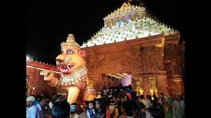
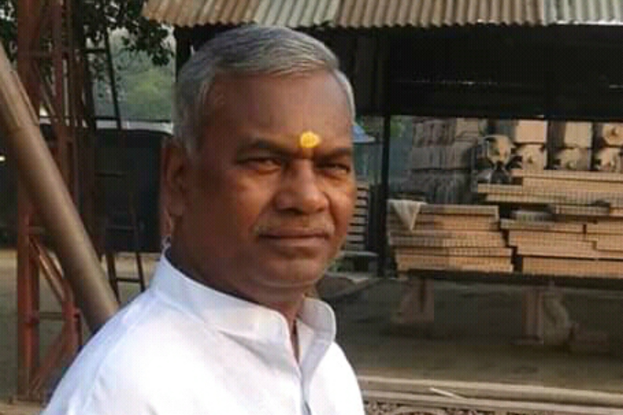
Source: ews18.com

Meghnath Oram had travelled to Ayodhya with small jattha of karsewaks from South Bihar’s Chota Nagpur division. Led by a Vishwa Hindu Parishad (VHP) functionary in Gaya region, the group had camped about a mile off the disputed site.

Oram since his arrival had shown signs of unrest. He had vowed to lay the foundation stone for a grand Ram temple at the site where Babri Masjid stood. Else, he would not return to his village.

To avoid any untoward incident, Kameshwar Chaupal, the VHP joint general secretary in-charge of tribal-dominated districts in Bihar, was asked to keep a close watch on Oram.

November 9, 1989 was the ‘auspicious’ day chosen by top Rashtriya Swayamsevak Sangh (RSS) and VHP leaders to performs shilanyas and lay the foundation for the ‘proposed grand temple’ at Ayodhya. It was to be the culmination of decade-long campaign led by the VHP and nurtured by the RSS.

Early that Wednesday morning, VHP leader Ashok Singhal’s close aide Rameshwar came looking for Chaupal. At the shilanyas site, very close to the disputed structure, Chaupal was accorded the coveted seat beside Singhal.

Swami Chinmayananda, who would go on to become a minister in the Atal Bihari Vajpayee government, was the master of the ceremony. With Rajmata Vijayaraje Scindia, seers and saints in attendance, the puja began.

In a powerful political statement, from a bevy of gurus lined up for the event, the VHP had chosen a Dalit boy from Saharasa in Bihar to lay the foundation stone of the Ram temple in Ayodhya, and of the BJP in national politics.

Once Shilanyas was done, Kameshswar Chaupal left Ayodhya for his village in Bihar.

On his arrival, Chaupal was told Baldev Jha, head of a prosperous Brahmin family had sent a message and wished to see him. “We had lived under centuries of subjugation, and I was reluctant. But my father coaxed me to go and meet Baldev Babu,” Chaupal recalled speaking to News18 in December, 2017.

For a person who had never entered an Upper Caste household in his village, Chaupal was unsure of the reception he would receive. “To my shock, Baldev Babu held my hand, made me sit beside him and asked everyone in the family, young and old, to touch my feet. They had read about me in the newspapers,” he recalled.

Chaupal later contested 1991 Lok Sabha elections from Rosada on BJP ticket, but lost. Chaupal tried his luck for the second time in 1995 Assembly polls. Five years later, he was nominated to the Bihar Legislative Council, where he served for two terms.

Ahead of the 2014 general elections, JD(U) had broken its poll pact with the BJP. It asked him to contest from a general seat. Chaupal lost to Pappu Yadav’s wife and Congress candidate Ranjeet Ranjan.

Sabrimala Temple at Ranchi railway station pandal

Source: dailypioneer.com

This festival season puja pandal revellers of the city will get a glimpse of ‘Gods own country’ right here in Ranchi. Known for showcasing the heritage of various Indian states like Rajasthamn, Odisha and Jharkhand in the past few years, this year at the Ranchi Railway Station puja pandal, Ranchiites will get to witness the vibrant art and culture of Kerala.

From creating a facsimile of the famous Sabarimala temple to portraying the renowned dance forms Kathakali and Mohiniyattam to the traditional boat race Vallam Kali conducted during Onam, this puja pandal will have it all.

At the main entrance of the pandal, the visitors will be greeted by statues inspired from the south and also 1000 diyas will be lit up. To give a view of the boat race a 60 feet boat is also being made from bamboo and hay with figures performing Kathakali and Mohiniyattam on it.

In the passage leading to the main idol 100 hands will be seen in the various mudras of the Bharatnatyam. The walls of the pandal will be decorated using about 700 ‘dafli’ with dancers painted in the centre performing the Mohiniyattam.

The idol of Goddess Durga which will be about 15 feet tall will be seen in the form of a Kathakali dancer. The other deities will also be in various dance postures. All the idols are being made of clay while the costumes and ornaments are being made to order from the south. “Every year the organising committee tries to portray the diverse culture of India.

Representing different states, this year the theme for the pandal is inspired from the state of Kerala. For people who are unable to travel, it is our attempt to introduce them to the various traditions and cultures of our country. It is also an effort to create awareness about old and dying dance forms,” said Munchun Rai, President Ranchi Railway Station Durga Puja Committee.

Bamboo, coconut rope and hay are primarily being used for the pandal structure and minimum use of theramcool is being ensured. The entire structure of the pandal will be about 30 feet high and 50 feet broad. The whole event is being primed at a whopping cost of Rs 30 lakh. The pandal will be open to take visitors from October 3.

The organisers are also giving special emphasis to conserve the environment. Food stall owners around the pandal premises are being asked to ensure cleanliness and dry and wet dustbins will also be placed at frequent intervals. The committee has asked RMC to collect garbage twice a day.

 To maximize security about 10 CCTV cameras will also be installed. Separate lines using barricades for male and female pandal hoppers will be made.

For the first time, the organising committee is conducting the event not on the main road leading to the Ranchi Railway Station but instead the puja pandal is being set up in a colony situated right behind the station.

Tracing Buddha 7-week journey at Mahabodhi Temple Complex after attaining nirvana

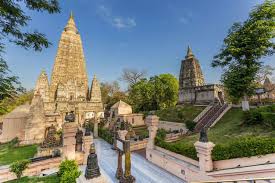
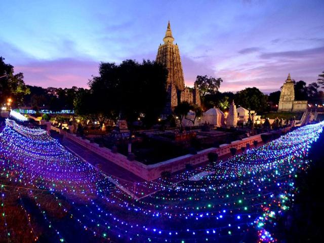
Source: timesofindia.indiatimes.com

Mahabodhi Temple Complex at Bodh Gaya is a pertinent pilgrimage site for the Buddhists and for all the followers of Gautam Buddha. A remarkable prince and sage, Buddha toiled throughout his life to spiritually uplift as many people as he could. Although there are a few places related to his life journey, the Mahabodhi Temple Complex is a special site. It was constructed at the behest of Emperor Asoka in the 3rd century, and later, it was renovated and expanded by the kings of the Gupta dynasty.

Timeline of Mahabodhi Temple Complex at Bodh Gaya

The temple is one of the most prominent temples in India. The significant events that occurred on its timeline are as under:

531 BC – Buddha attained the perfect state of enlightenment while being seated in meditation under a Bodhi tree at the site of Mahabodhi Temple Complex.

260 BC – Emperor Asoka visited the site of Bodhi tree to worship it, and made the first temple for honouring Gautam Buddha.

Gautam Buddha attainted enlightenment or nirvana and spent a span of seven weeks after that across various spots where the Mahabodhi Temple stands today. From battling the inner and external demons during his meditation to fiercely resisting the various temptations that came his way, Buddha covered great milestones in his inner sacred journey at different parts of the Mahabodhi temple. Ahead, we throw some light on the seven weeks he spent post nirvana.

Bodhi Tree at Bodh Gaya

The Bodhi Tree is the most illustrious site situated to the west of the main temple. It is believed to the direct descendant of the Bodhi Tree underneath which the Buddha stayed for the first week after attaining enlightenment.

Prayer Hall

Buddha spent his second week at the prayer hall, also known as Animeshlochan Chaitya. It can be found towards the north of the central path on a raised platform.

Jewelled Ambulatory

This jewelled ambulatory is also called Ratnachakrama. It is famous for being the site where the Buddha spent the third week of his internal journey walking eighteen steps back and forward. It is located near the north wall of the main temple.

Ratnaghar Chaitya

Located towards the north-east near the enclosure, Ratnaghar Chaitya is the place where the Buddha spent his fourth week.

Ajapala Nigrodh Tree

During his fifth week, the Buddha was meditating under Ajapala Nigrodh Tree and answered the questions posed by the Brahmins.

Lotus Pond

The sixth week was spent by Gautam Buddha at the Lotus pond situated outside the enclosure to the south of the temple complex.

Rajyatana Tree

Buddha was here during his seventh week of meditation. A tree has been planted to mark this site. It is located towards the south-east of the temple.

The Main Temple at the Mahabodhi Temple Complex at Bodh Gaya is a masterpiece that showcases the best of Buddhism architectural creativity. Whether you are a Buddhist or not, you will find this place interesting to visit. So visit it and be blessed with one of the most sacred religious places in India.


Pradhan Seeks Inclusion Of Srimandir, Konark Temple In Iconic Tourist Destinations

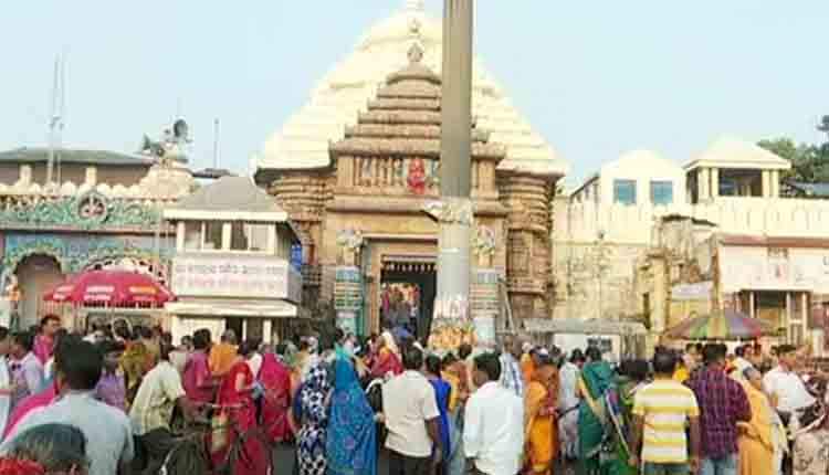
Source: odishatv.in

Bhubaneswar:  After a single heritage site from Odisha was not included in the list of 17 sites to be developed as ‘Iconic Tourist Destinations’ as announced by the Centre in the Union Budget 2019-20, Union Minister Dharmendra Pradhan has stressed on inclusion of Sun Temple and Puri Jagannath temple in the ambitious scheme.

In a letter to Union Minister of State (I/C) Tourism, Prahalad Singh Patel, Pradhan has highlighted that Odisha is home to several wonderful cultural and natural heritage sites. Among the several popular tourist destinations, Puri Jagannath temple and Konark Sun temple are the holiest pilgrimage and attractive tourist destinations in the State.

“Together with Bhubaneswar, Puri and Konark form Odisha’s golden triangle attracting millions of tourists and pilgrims from around the world and are breathing incarnations of Odisha’s socio-cultural identity,” wrote Pradhan.

The social fabric of Odisha is held together by seams of rich cultural history and devotion to Lord Jagannath. The Jagannath Temple at Puri is the ceremonial home of Odisha’s most revered deity, Lord Jagannath, and one of the four holiest dhams for Hindus. Host of the iconic Rath Yatra, the Puri Jagannath Temple is unifying beacon of Odisha’s quintessential Jagannath cult.

Pradhan further wrote that the Konark Sun Temple, the 13th century marvel is acknowledged as the zenith of Odishan architecture and recognized globally as UNESCO world heritage site.

“Keeping in mind the paramount historical, cultural and religious importance of Sun Temple in Konark and Lord Jagannath Temple in Puri for the people of Odisha, I request your personal intervention for inclusion of Sun Temple in Konark and Lord Jagannath Temple in Puri in the Iconic Tourist Sites,” Pradhan wrote in his letter.

Earlier, the Union Ministry of Tourism had identified several sites in 11 States under the Iconic Tourist Sites Development Project.

The sites include- Taj Mahal and Fatehpur Sikri in Uttar Pradesh, Ajanta and Ellora in Maharashtra, Humayun’s Tomb, Red Fort and Qutub Minar in New Delhi.

Other sites are Colva beach in Goa, Amer Fort in Rajasthan, Somnath and Dholavira in Gujarat, Khajuraho in Madhya Pradesh, Hampi in Karnataka, Mahabalipuram in Tamil Nadu, Kaziranga in Assam, Kumarakom in Kerala and Mahabodhi in Bihar.

Patna: Tej Pratap Yadav dresses up as Lord Shiva; offers prayers at temple

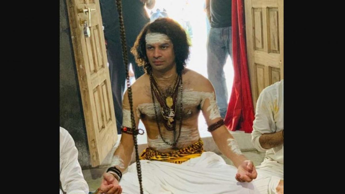
Source: dnaindia.com

Amid the ongoing ‘Shravan month’, Lalu Prasad Yadav’s elder son Tej Pratap Yadav on Tuesday dressed up as Lord Shiva and offered prayers at a Shiva temple in Patna.Embracing Lord Shiva’s look, Tej Pratap wrapped up himself in a white dhoti, painted tiger skin-like fabric on waist and applied ash on his body including hands, forehead and chest. In the image, he was seen wearing a traditional Hindu rosary around his neck.

The RJD leader, who reached here with his bodyguards, was seen flaunting his long hair to look identical to Lord Shiva. He offered milk and Gangajal (holy water) to Lord Shiva.This is not for the time as even last year Tej Pratap had worn the similar attire during the ‘Shravan month’. He had said the prayers were being offered for the welfare of Bihar and its natives and also for his father’s health.

“Will pray for the welfare of the people of Bihar and the entire nation so that everybody lives in peace, in harmony, without any divide or barrier. I will also pray for the health of my father, will pray for his long life,” he had said.

In May 2018, the poster was seen outside the residence of Lalu, depicting his son Tej Pratap and ex-wife Aishwarya as Lord Shiva and Goddess Parvati, respectively.

In 2017, he had dressed up as Lord Krishna to celebrate the beginning of the New Year. Donning Lord Krishna’s avatar, he was spotted playing the flute with a red turban on his head 

Bodh Gaya’s Mahabodhi Temple to Receive New Hi-tech Illumination System

Source: buddhistdoor.net

The Mahabodhi Temple in Bodh Gaya, India, one of the most sacred Buddhist sites in the world, will soon by illuminated by a state-of-the art LED lighting system by the end of this year, with funding for the extraordinary initiative offered by Siddhartha’s Intent India with support from Khyentse Foundation and Vana Foundation. The new lighting system is designed to illuminate every part of the temple in accordance with the highest safety and quality standards to ensure a long-lasting and sustainable solution.

The project, called “Lighting the Mahabodhi,” is one of the largest and most ambitious light-offering initiatives in Buddhist history. According to the Bhutanese newspaper Kuensel, Dzongsar Khyentse Rinpoche, founder of Khyentse Foundation, who initiated the lighting project, came up with the idea in 2015, and in 2017 the proposal was approved by the Bodh Gaya Temple Management Committee and the Gaya District Magistrate. The total cost of project is around US$1.4 million, with more than 30 per cent of the budget allocated since the project was launched.

“If there is one thing in the world that resembles our minds, it is light,” said Dzongsar Khyentse Rinpoche. “As Buddhists in the Rime tradition, our aim is to illuminate our minds free from judgment, prejudice, or pride. And so, it is to symbolize that realization and to appreciate the Buddha’s infinite compassion and skillful means in guiding us toward it, that we are now offering light at the very place of the Buddha’s enlightenment.” (Kuensel)

The Mahabodhi Temple, one of the most spiritual destinations for Buddhists pilgrims, is a UNESCO World Heritage Site marking the place where the Buddha is said to have attained enlightenment. Beside the temple, there are seven other sacred sites in Bodh Gaya, including the descendent of the original Bodhi tree.

“The atmosphere created by the Mahabodhi Temple is so potent it’s as if you fall into a trance,” explained Dzongsar Khyentse Rinpoche. “Here you’ll find the vajra seat (vajra asana, also known as the Diamond Seat) where, after many years of searching for the truth and six excruciating years of penance by the banks of the Niranjana River, Siddhartha finally discovered the Middle Path and achieved enlightenment under the Bodhi tree. (Khyentse Foundation)

“Centuries have passed since the Buddha attained enlightenment at this spot, and the temple has weathered many eras of both resplendence and shocking neglect. In this present era, the temple has been upgraded, is well tended to, and in comparatively excellent shape,” said the president of Siddhartha’s Intent India, Prashant Varma, in a press release on 31 May. “Lighting the Mahabodhi is building upon this support to update the lighting in a way that will last for generations to come. (Khyentse Foundation)

B-Lit, a lighting design company from Bangkok, Thailand, is providing the design offering free of charge as an offering of devotion. The overall lighting system will include high-end LED technology, as well as software to control and automate the myriad of high-efficiency, low-heat LED bulbs and fixtures.

According to the Khyentse Foundation, the lighting project will incorporate: 

Automated lights that are durable, energy efficient, and ecologically friendly, with minimal light pollution.
• Top technical quality lighting with systematised controls.
 Synchronized with the lunar cycles, and adaptable to the many special rituals and needs of the Mahabodhi Temple.
 Light fittings and fixtures able to withstand changing seasonal and weather conditions.
 Safe and easy operation and maintenance.

“We hope to have part of phase one—the core of the temple lighting—ready by the end of this year,” noted Varma. “We shall then steadily work toward completing all other areas of the temple complex, other than the Sarovar Lake and the new Meditation Park, by the end of 2020.” (Kuensel)

Betla National Park

Betla National Park-Jharkhand
About:
Situated in the district of Daltonganj, Palamau Sanctuary is spread over an area of 979sq.km. The core area of 232 sq. kms of the sanctuary was declared as Betla National park in September1989. The park occupies the western parts of the Chotanagpur plateau and was constituted in the year 1960 as an extension of the Hazaribagh National park. Palamau has the distinction of being the forest where the world’s first tiger census was enumerated in 1932. The park became one of the earliest 9 tiger reserves in India under ‘Project Tiger’ in 1974.  

The forests of the park have a vast range of vegetation consisting of tropical wet evergreen forests in the lower reaches, mixed (moist & dry) deciduous forests in the middle and temperate alpine forests in the upper reaches including Sal and bamboo as the major components along with a number of medicinal plants. The river Koel and its tributaries run through the northern portion of the park. There are grasslands in the river flowing area. It has waterfalls and hot springs too. Once the seat of Chero kings, there are two historical forts, one of them belonging to the 16th century deep inside the forest. The main sentinel of the old fort is visible high up on the hill with defences in three directions and three main gates.

The diversity of eco-system promotes a wide variety of fauna consisting of elephant, panther, leopard, wild boar, tiger, gaur, sloth bear, sambar, chital, nuntjac, nilgai, langur, mouse deer, monkeys, small Indian civet, mongoose, jackals, porcupine, ant eating pangolin etc. Elephants in large numbers are seen mostly during the monsoons up to the time when water sources begin to dry up in March. Jackal and hyena are common scavengers. Bird-life is rich featuring the hornbill, peafowl, red jungle fowl, black partridge, white necked stork, black ibis, swamp grey, quail, the pied born bill, wagtails, the harial, doves, drongo, the crested serpent-eagle, forest owls, the papiha and other birds usually found in dry deciduous forests. The famous Kamaldah lake attracts several varieties of water birds including the common whistling and cotton teal, the comb duck, snipe and geese. The rhesus monkey and the common languor provide attraction to children visiting the park.
Location info:
Address:Daltonganj,Ranchi,Jarkhand,India
District: Daltonganj
Nearest City: Daltonganj
Best time to visit: October to May
Climate/Weather:
The climate of this region is extreme with the maximum temperature going well over 40°C in summers. In total contrast to this, winters are quite cold with the minimum temperature dipping to 3°C. The monsoon months are from July to mid September.
History:
Betla national park is nestled in the lap of Deccan Plateau which includes 1,026 km² of Palamau Tiger Reserve in the state of Jharkhand. An additional 226 km² was added to the park in 1989 and 63 km² of the Mahuadar wolf sanctuary was added to national park.
Interesting things to do:
Visit the historical monuments that the national park houses. Purana Quila and Naya Quila are important attractions for tourists. Though they are named the Old Fort and the New Fort, they seem to be built around the same time.Enjoy stunning views from the watchtowers and the ground hides that have been recently added to enhance the charm of wildlife spotting in the park.Other attractions that one must visit here include waterfalls and hot springs.Elephant rides into the jungle of Betla are a major draw for tourists visiting here.
Interesting things to Visit:
Fauna:
Large herds of Gaur and Chital are commonly seen. Elephants are present mostly after the monsoons up to the time when water holes begin to dry up in March. Tiger, Panther, Sloth Bear, Wild Bear, Sambhar, Nilgai, Kakar, Mouse Deer are also permanent residents. Large families of langurs are an ever present attraction. Palamu is now one of the nine Tiger Reserves in India under Project Tiger
Mobile range info:
 
How to reach?
Nearest Railway Station:Daltonganj (25 km away) Railway Station
Nearest Airport:Ranchi, situated around 140 km away, is the airport with regular air connections to Delhi, Calcutta, Patna and Lucknow.
Road Transport: Betla is well connected to Daltonganj (25 kms) via Khudia morh (6km), Ranchi (140 kms), Hazaribagh (190 kms), Netarhat (211 kms), Patna (384 kms), Calcutta (575 kms) etc by regular buses run by the state transport corporation and private companies.  
Nearest Visiting places:
Shahpur:
Opposite Daltonganj on the west bank of the Koel is the village SHAHPUR in which Gopal Rai, the Raja of Palamu built a palace in the end of the 18th century. Shahpur stands on a high tract of land and the ruined place, the white temple and the masonry building present a picturesque view from Daltonganj. A nearer view of the palace is disappointing for what looks in the distance like an imposing edifice is seen to be half- finished building of little architectural importance.  

Palamau:
Palamau on the Auranga river , 20 miles south-east of Daltonganj as the crow flies, from which the district takes its name is for historian and archaeologist the most interesting place in the district, for it was for many years the seat of the Chero chiefs and it contains the ruins of the two great forts built by them, the capture of which by Mughals and later by the British resulted in the collapse of the Chero resistance, the forts lie within the reserved forests and in order to preserve them the jungle has to be cut back at intervals .they are a favourite haunt of tigers, whose pug marks may nearly always be seen in and around the fort.The walls which are in preservation are about 5 feet in thickness and those of the old fort bear marks of cannon balls and bullets in many places.

Netarhat:
The plateau of Netarhat in Palamu district is comparatively unknown to the tourists from outside although it is one of the rare beauty spots which is capable of great development. About a century back, it is understood, there was a military camp at Netarhat. The camp had to close down because sufficient good water was not available. It was left to Sir Edward Gait, Lt. Governor of Bihar and Orissa to give a great Importance to the plateau. Sir Edward and after him many of the Bihar and Orissa and later Bihar Governors use to spend a part of the summer exodus at Netarhat . Netarhat although situated in Palamau District is more easily accessible from Ranchi, the summer head quarter of the Old Bihar Govt. it is at a distance of 96 miles from Ranchi, the last 12 miles of which commencing from Banari runs through the hilly section and is typical of any of the other hill stations. There is an excellent all weather road of morum which is capable of widening at some places. The cars can pass conveniently.
plateau:
A plateau, four miles long and two and a half miles broad. It is in the extreme of the district, the highest point of which is 3,800 feet above the sea level. It is in Mahuadanr police station and is 96 miles west of Ranchi across seven hills. This is the highest point on the plateau of Chhotanagpur. Netarhat is a place of peculiar charm which has a laid its spell on many casual visitors. The stillness of the jungle and the cool and refreshing air brings relief from the dust and heat of the plains. Netarhat has a game sanctuary amidst pine forest the bestow singular arboreal interest in this part. Some time back it used to be the permanent summer station of the Governor.

Palamau National Park:
Palamau is one of the popular national parks of India. Palamau is situated within the lndo-Malayan realm and is rich in flora and fauna, though the area is prone to severe droughts. There are 107 villages in the buffer area and three in the core with a human population of 65,000 and a livestock population of 45,000. The core is distributed into two parts, the actual core and the recently inducted ‘satellite core’. The park was brought under Project Tiger in 1973 and is among the first nine Tiger Reserves of the country. The core area was declared a National Park in September 1989.

Hazaribagh:
The Hazaribagh National Park is one of the most significant wildlife sanctuaries in Jharkhand. The sanctuary is located at a height of about 615 meters on a low-altitude hilly region of the state. The Hazaribagh National Park in Jharkhand spans across a huge region.This national park covers a total area of 184 square kms. The Hazaribagh National Park has a tropical type of climate, where it is quite cold during winter and quite hot during summer.
Nearest Petrol Pump:
Ambalal Patel Petrol Pump:GARHWA,Jharkhand,India,ph:06561 222270
Hotels/Lodge/Accommodation:
Hotel Van Vihar:Betla,Palamu,Jharkhand,india
Things to carry:
 
Tips & Suggestions:
 
Help Line/Phone Number:
Police Station:100
Nearest Hospital:Government Hospital:Garhwa,Jharkhand,India
Society/Community Phone Number:
Link:

Hazaribagh National Park

Hazaribagh National Park-Jharkhand
About:
The Hazaribagh National Park is one of the most significant wildlife sanctuaries in Jharkhand. The sanctuary is located at a height of about 615 meters on a low-altitude hilly region of the state. The Hazaribagh National Park in Jharkhand spans across a huge region. This national park covers a total area of 184 square kms. The Hazaribagh National Park has a tropical type of climate, where it is quite cold during winter and quite hot during summer.  

The Hazaribagh National Park at Jharkhand offers a variety of vegetation starting from low-altitude stretches of grassland to thick tropical vegetations. The wildlife sanctuary of Hazaribagh National Park has a wide range of topography from low-lying regions to high hills and rolling regions.

The Hazaribagh National Park has abundant wild animals like the Chital, Nilgai, Panther, Sambar, Sloth Bear, Tiger and Wild Boar. The Cheetal, Kakar, Nilgai, Sambar and Wild Boar are among the most easily and often spotted animals particularly near the waterholes at the time of the dusk. The population of the tigers is very less. According to 1991 Census, there were 14 tigers in the park. The tigers are really difficult to sight.

A 111-km long stretch of the road in the sanctuary takes the tourists to the remotest corners and masonry towers of the park. The road, strategically laid down, offers excellent opportunities for the view of the wild animals. The tribal population also lives around the sanctuary. The ark has many watchtowers that act as the perfect hideouts to see the wildlife in its natural surroundings.
Location info:
Address:Hazaribagh National Park, Koderma,Jarkhanad,India
District: Koderma
Nearest City: Koderma
Best time to visit: October to March
Climate/Weather:
The climate in this region is tropical with hot summers and cold winters. Temperature during the summer months touch a high of 41.1’C and a low of 19.4’C. Winter months are better and the temperature ranges between a maximum and minimum of 19.4’C and 7’C. The monsoon months are July to mid-September.
History:
Eversince the Hazaribagh National Park was developed in 1954, it was known by that name but when the formal listings of the national parks was made by the United Nations, it was not included in it.On 24th June 2007, Deputy Chief Minister of Jharkhand announced that soon Hazaribagh will have an state-of-the-art Elephant Park, if this project materialize it would attract more tourist.
Interesting things to do:
Put off all music and cut off all sound. Don’t frighten animals away. Leave the animals to themselves and just watch them from a distance. Also, put your vehicles light dim because too much may frighten the animals.
Interesting things to Visit:
Fauna:
Sambhar, nilgai, chital and kakar can be seen at dusk and dawn, enjoying at water holes. Sloth bear might be encountered unexpectedly. It is a matter of chance that one sees a tiger or a panther. The last time a Tiger was sighted in the vicinity of the Forest Rest House was in 2006, as reported by the caretaker when the Tiger had killed a prey. I was very lucy to watch a Tiger from a distance of barely 30 feets while on foot; But that was way back in 1989. I still cherish the memory.  

Landscape:
The national park is located on the Chotanagpur plateau. It stretches over 184 sq km of undulating countryside, steep hills and deep drainage channels with thick tropical forests and grass meadows, at an average altitude of 615 meters. There are small rivers and a number of dams have been constructed to form artificial lakes within the park.

Hazaribagh Lake:
The Hazaribagh lake also attracts various tourists. It is a popular picnic spot and place for water sports.

Jilaiya Dam:
This dam, situated across Barakar River is a preferred attraction for the tourists. It is 55 kms away from Hazaribagh. The main road from Bath, on C.T Road passes through the reservoir and the hillock offers a breath-taking sight.

Hazaribagh Hill:
Hazaribagh is the famous hill resort to relax and enjoy the natural scenery. Hazaribagh literally means the land of thousand gardens and is situated at an altitude of 2019 feet above the sea level and set amidst hilly and forests on the opposite side of the Damodar Valley. It has excellent climate and scenic beauties all around it in the midst of dense forest which is quite rich in flora and fauna. Hazaribagh is well known for the Hazaribagh Wildlife Sanctuary. This place attracts tourists from all over the world who come here to visit the sanctuary, waterfalls and dams located in the vicinity. The best season to visit Hazaribagh is from October to April.
Mobile range info:
 
How to reach?
Nearest Railway Station: Koderma railway station , which is 59 km away, or alternately one can approach the park from the Hazaribagh Road railway station (67 km) on the Howrah-Delhi Grand Chord line.
Nearest Airport:Ranchi (91 km) ariport is connected with Calcutta, Patna, Lucknow and Delhi by regular Indian Airlines flights.
Road Transport: Hazaribagh town is connected by road to Ranchi 91 km, Dhanbad 128 km, Gaya 130 km, Patna 235 km, Daltongunj 198 km, and Calcutta (via Asansol-Govindapur-Barhi) 434 km. The Hazaribagh National Park is 19 km from the Hazaribagh town. Regular bus services connect the town with Koderma, Hazaribagh Road railway station, Patna, Gaya, Ranchi, Dhanbad, Daltongunj and other nearby places.Unmetered Taxis, Auto Rickshaws, Cycle Rickshaws and Taxis are available for the park from the Hazaribagh town. The approximate charge for a taxi is Rs. 160 for a two-way journey.
Nearest Visiting places:
Rajarappa Waterfalls:
Rajarappa Waterfalls is situated about 89 km. from Hazaribagh. The Rajarappa Waterfalls is believed to be one of the 51 sacred sites where a part of the body of Sati, the spouse of Lord Shiva fell. In this falls, the Bhera river joins the Damodar river from a height of 20 feet. A temple dedicated to Devi Chinnamasta is situated on the top of the hill. The little waterfall also offers boating facilities which introduces some very spectacular rock formations in this area.  

Tilaiya Dam:
Tilaiya Dam is a small dam that is situated on the Patna-Ranchi road and 55 kms from Hazaribagh. This dam produces only 4000 kw. of power. This was the first dam and hydro-electric power station that was built by the Damodar Valley Corporation for controlling floods across Barakar river in Hazaribagh district. It is 1,200 ft. long and 99 ft. high. It is situated in an ideal surrounding with a reservoir stretching in 36 sq. kms. This dam is mainly visited for its picturesque setting with its hills and reservoir with motor boats, swimming, terrace gardens and deer park.

Canary Hills:
The Canary Hills is located close to the town. The Canary Hills has a well laid out park and studded with three small lakes and an observation tower. From the top of the hill one can have a panoramic view of the town.

Parshnath Temple:
Parshnath Temple is situated at the top of the Parshnath Hill, the highest hill in the Giridih district in Bihar. It is situated about 200 km. from Pawapuri and 8 km. from Giridh. The path to the hill top passes through the Madhuban village from where it is an 11 km. trek. It takes almost a full day to reach the Parshnath Hill and to the temple and to come back. The Parshnath Hill is a famous abode for Jains as about 23 out of 24 Tirthankaras (including Parsvantha) are believed to have attained salvation in the Sammetasikhara of the Parshnath hills. The Parshnath hill is named after the 23rd Tirthankar Parsvanatha and rises steep above the plains of Dhanbad to a height of 1,365 metres. The Prasvantha, 23rd Tirthankar was very popular among tribal population of Chotanagpur. He is identified by the snake king Dharanendra, whose many hoods protect the meditating Tirthankar. Both the Swetamber and Digamber Jains have many beautiful temples here on the hills.

Shahpur:
Opposite Daltonganj on the west bank of the Koel is the village SHAHPUR in which Gopal Rai, the Raja of Palamu built a palace in the end of the 18th century. Shahpur stands on a high tract of land and the ruined place, the white temple and the masonry building present a picturesque view from Daltonganj. A nearer view of the palace is disappointing for what looks in the distance like an imposing edifice is seen to be half-finished building of little architectural importance.

Palamau:
Palamau on the Auranga river , 20 miles south-east of Daltonganj as the crow flies, from which the district takes its name is for historian and archaeologist the most interesting place in the district, for it was for many years the seat of the Chero chiefs and it contains the ruins of the two great forts built by them, the capture of which by Mughals and later by the British resulted in the collapse of the Chero resistance, the forts lie within the reserved forests and in order to preserve them the jungle has to be cut back at intervals .they are a favourite haunt of tigers, whose pug marks may nearly always be seen in and around the fort.The walls which are in preservation are about 5 feet in thickness and those of the old fort bear marks of cannon balls and bullets in many places.

Netarhat:
The plateau of Netarhat in Palamu district is comparatively unknown to the tourists from outside although it is one of the rare beauty spots which is capable of great development. About a century back, it is understood, there was a military camp at Netarhat. The camp had to close down because sufficient good water was not available. It was left to Sir Edward Gait, Lt. Governor of Bihar and Orissa to give a great Importance to the plateau. Sir Edward and after him many of the Bihar and Orissa and later Bihar Governors use to spend a part of the summer exodus at Netarhat. Netarhat although situated in Palamau District is more easily accessible from Ranchi, the summer headquarter of the Old Bihar Govt. it is at a distance of 96 miles from Ranchi, the last 12 miles of which commencing from Banari runs through the hilly section and is typical of any of the other hill stations. There is an excellent all-weather road of morum which is capable of widening at some places. The cars can pass conveniently.
plateau:
A plateau, four miles long and two and a half miles broad. It is in the extreme of the district, the highest point of which is 3,800 feet above the sea level. It is in Mahuadanr police station and is 96 miles west of Ranchi across seven hills. This is the highest point on the plateau of Chhotanagpur. Netarhat is a place of peculiar charm which has a laid its spell on many casual visitors. The stillness of the jungle and the cool and refreshing air brings relief from the dust and heat of the plains. Netarhat has a game sanctuary amidst pine forest the bestow singular arboreal interest in this part. Some time back it used to be the permanent summer station of the Governor.

Palamau National Park:
Palamau is one of the popular national parks of India. Palamau is situated within the lndo-Malayan realm and is rich in flora and fauna, though the area is prone to severe droughts. There are 107 villages in the buffer area and three in the core with a human population of 65,000 and a livestock population of 45,000. The core is distributed into two parts, the actual core and the recently inducted ‘satellite core’. The park was brought under Project Tiger in 1973 and is among the first nine Tiger Reserves of the country. The core area was declared a National Park in September 1989.

Betla National Park:
Situated in the district of Daltonganj, Palamau Sanctuary is spread over an area of 979sq.km. The core area of 232 sq. kms of the sanctuary was declared as Betla National park in September1989. The park occupies the western parts of the Chotanagpur plateau and was constituted in the year 1960 as an extension of the Hazaribagh National park. Palamau has the distinction of being the forest where the world’s first tiger census was enumerated in 1932. The park became one of the earliest 9 tiger reserves in India under ‘Project Tiger’ in 1974.
Nearest Petrol Pump:
Lakshmi petrol pump:NH 100,Hazaribagh,Jharkhand,India  
Koltex petrol pump:NH 100,Hazaribagh,Jharkhand,India
Ramnagar Petrol pump:Road No 4,Hazaribag,Jharkhand,India
Hotels/Lodge/Accommodation:
Lotus Nikko Bodhgaya Hotel:Bodhgaya,Gaya,Bihar,India  
Hotels Bodh Gaya:Bodhgaya,Gaya,Bihar,India
Things to carry:
 
Tips & Suggestions:
 
Help Line/Phone Number:
Police Station:100
Nearest Hospital:
Holy Family HospitalL::Koderma,Jharkhand,India
Sadar Hospital Hazaribagh:NH 100,Hazaribag,Jharkhand,India
Society/Community Phone Number:
Link:

Valmiki national park

Valmiki national park-Bihar
About:
The Valmiki National Park is well dispersed across a pulsating plot that approximately measures 335.64 square kilometers and is sited in the western outskirts of the territorial domain named Champaran that forms a part of the premises of Bihar. Incidentally the Valmiki National Park is a wee fragment of the mammoth Valmiki Sanctuary that covers a sprawling area of around 800 square kilometers.  

The Valmiki National Park made its innocuous presence felt in the early 1990s and since then has procured an apt abode to the flamboyant and majestic creatures regarded as the tigers. In fact, the Valmiki National Park vanquishes the fourth spot in the standings of the reserves that houses maximum number of tigers.

The placid waters of the rivulet called Gandak and the magniloquent apex of the Mount Everest on the western fringe presents a serene and timid ambiance to the Valmiki National Park at Bihar where the king of the beasts can stomp around on the lush grasses with pride and elation.

The Valmiki tract is broken and undulating often showing highly fragile geological formations. As a result, there are steep ravines, knife-edge ridges and precipitous walls formed by landslips and soil erosion.

The great Gandak and the Masan rivers collect all the water from the numerous, tortuous tributaries. These rivers and streams keep changing course from side to side, facilitated by the erosion-prone sandy and immature soil of the banks. Seasonal rivers like Panchanad, Manor, Bhapsa and Kapan display peculiar behaviour of erosion at one place and deposition of transported soil at another place.

Hill system is the continuation of Siwalik Range, largely made of imperfectly compacted and ill-formed sandstone dotted with pebbles and boulders. Owing to the fragile nature of parent rock material, the soil produced at the foothill is immature, loose sand and display sheet. The menace is further aggravated by maltreatment of the forests by people in general, frequent fires and heavy grazing.

The park consists of moist Sal bearing forests, dry Sal bearing forests, moist mixed deciduous forests without Sal, cane and tropical seasonal swamp forests containing reed beds and wet grasslands. The species found in the park include tiger, sloth bear, wolf, various species of deer, serow, leopard, python, peafowl, chitals, sambars, nilgais, leopards, hyenas, Indian civets, Jungle cats, Hog deer, wild dogs etc. One horned rhinoceros and Indian bison often migrate from Chitwan to Valmikinagar. There are 8 villages in the buffer area but no habitation in the core area.
Location info:
Address:valmiki national park ,Patana,Bihar,India
District: Patna
Nearest City: Valmiki nagar
Best time to visit: October to February
Climate/Weather:
Summer: 43 °C – 30 °C, Winter: 21.4 °C – 5 °C
History:
The Valmiki Tiger Reserve, the 18th Tiger Reserve of the country and second in Bihar, is located in the northern most part of the West Champaran district of the State. Core area was declared as a National Park in 1989. Government of Bihar had notified 464.60 sq. km. area as Valmiki Wildlife Sanctuary in 1978. Later on, in 1990 an area of 419.18 sq. km. was added to the Sanctuary. Thus Valmiki Wildlife Sanctuary embraces a total area of 880.78 sq. km.
Interesting things to do:
 
Interesting things to Visit:
Lauriya Nanadan Garh: 
There is lion pillar of Ashoka, which is a single block of polished sand stone, 32′-9.5″ in height with a diameter of 35.5″ at base and 26.2″ at the top. The pillar is over 2000 year old and in excellent condition. Nandgarh is a huge mound composed of bricks and is about 80 feet height. According to a authoritative source, it is an Ashok Stupa in which ashes of Buddha’s funeral pyre were enshrined.  

Bawan Garhi: 
A name meaning 52 forts. It is also known as Tripan bazar. The remains of 52 forts and Tripan bazar are at Darubari.

Someshwer Fort: 
Someshwar Fort is situated in Narkatiagani sub-division, near Nepal border, on top of the Someshwar hill at 2884 ft above M.S.L. It is in ruined state but its remains are well defined.

Triveni: 
A holy place of Hindu. The name is derived from the fact that three rivers (Gandak, Sonha and Pachanad) merge here soon after they emerge from the hills. Triveni is also believed to be the site at which the fight commenced between Lords of Forest and Water (the Elephant and Crocodile).
Forest:
Bhabar Dun Sal Forest ,Dry Siwalik Sal Forest ,West Gangetic Moist Mixed Deciduous Forest ,Khair – Sisso Forest ,Cane brakes ,Eastern Wet Alluvial Grassland , Barringtonia Swamp Forest .

Flora:
Sal (Shorea robusta), Asan, Karama, Semal, Khair, Cane(Calamus tenuis), Jamun, Siccharrum, Mahulan, Piper, Lagun (Peepar)
Main Species:
Tiger, Leopard, Fishing Cat, Leopard Cat, Chital, Sambar, Hog Deer, Black Buck, Gaur, Sloth Bear, Langur, Rhesus Monkey .
fauna and flora:
There is no poaching in core area. Poaching is occasional in the buffer area but as the northern and Western boundaries of the Reserve lie along Nepal and Uttar Pradesh respectively. There is serious problem of poaching and smuggling of teak and cane from Madanpur block of the Reserve to different parts of Nepal e.g. Susta, Ratanganj and Rani Nagar. Armed gangs settled in Nepal are involved in illicit felling.

Valmiki temple:
A Valmiki temple is called an Ashram, which means a hermitage or monastery. It is the communal house for Valmikis. The function of the Ashram is to serve as a center for building up the commitment of devotee’s and for transmitting the Ramayana’s message, and the focal point for the whole community to preserve their culture and traditions.The Ashram is open to all who wish to enter, anyone who goes to the Ashram is welcome to stay as long as they wish and are welcome regardless of race, gender, caste or creed.

Kutagarshala:
It lies at a distance of 3 kilometers from the main town and was constructed by the Lichchavis for Sakhamuni. A large tank, open courtyard and verandah are all that is left of this once famous monastery. In the north of this very site is the Ashokan pillar to commemorate the place where Buddha delivered his last sermon.Amvara or Amrapali’s mango grove: Amrapali the famous courtesan gifted here mango orchard Amvara to the Buddhist Sangha after she heard Buddha delivered his sermon.The ruins of Kings Vishala’s fort from whom the town gained its name, is also a major Tourist Attractions in Vaishali. Abhisekh Puskarini is the sacred coronation tank. The Japanese temple built by Nipponzan Myohoji sect of Japan is another interesting place in Vaishali. Sonepur:
A small sleepy town close to Hazipur, Sonepur comes alive every year on Kartik Purnima when one of the largest cattle fairs of Asia is organised. A whole lot of people turn up to be a part of this fair from both India and abroad. The Bihar state Tourism Development Corportaions make accommodation arrangements in traditional huts for visitors coming to this fair. Muzaffarpur:
Muzaffarpur is located 35 km from Vaishali and is also known as the lychee kingdom. In ancient times, it is believed, Muzaffarpur, along with the modern district of Champaran and Darbhanga, formed the Lichchavi kingdom. Today, the city is one of the most important one in north Bihar and has plenty of historical sites in closeby areas to roam around.
Mobile range info:
 
How to reach?
Nearest Railway Station:The Valmiki Nagar rail head is 5km from the park.
Nearest Airport:Patna airport is at Patna at a distance of 295km.
Road Transport:There are bus services from Valmiki Nagar to Bettiah ( 80km) the nearest town.
Nearest Visiting places:
Gol Ghar:
This bee hive shaped granary was built in the year 1770 after the outbreak of a terrible famine. It is one of the oldest British structures in the city and once you reach its top after climbing a series of steps, you will get a good view of the River Ganges and the city.This enormous beehive-shaped structure was constructed as a state granary. A series of surrounding steps lead to the top of this huge building that commands a nice view of the river Ganges and Patna city.  

Harmandirji:
Built by Maharaja Ranjit Singh, this dome shaped structure houses many Sikh scriptures and personal belongings of Guru Gobind Singh.The shrine was built to consecrate the birthplace of Guru Gobind Singh, the tenth Sikh Guru (prophet). Many Sikh scriptures and the personal belongings of the prophet are preserved in this dome-shaped structure.

Kumhrar:
Nearly 5km away from Patna, this is the site of ancient Mauryan capital Patalipra. A huge 80-pillared hall of the Mauryan dynasty is an important find from the excavation.An archaeologist’s delight, this spot is marked by a huge 80 pillared hall. It is actually the ruins of Ashokan Pataliputra which in its heyday was comparable to Venice of the East.

Jalan Museum:
The Museum has been constructed at the site of the fort of Sher Shah. The personal museum preserves a great collection of jade, Chinese paintings and silver filigree work of the Mughal period.The personal collection of Diwan Bahadur Radhakrishnan Jalan is housed in this museum. The jade collection, the beautiful Chinese paintings and the exquisite filigree work of the Mughal period form a part of its excellent repertoire.

Agam Kuan:
This archeological remains of a deep well is one of the major tourist attractions in Patna. It is believed to be associated with the time of Ashoka.Believed to date back to the Ashokan period, this deep well draws a large number of visitors.

Patna Museum :
Locally known as the Jadu Ghar, this museum houses an amazing collection of bronze sculptures and terracotta figures. Its most precious object is the Didarganj Yakshi.The museum displays a prized collection of archaeological finds from different sites in Bihar. Metal and stone sculptures of the Maurya and Gupta Periods, terracotta figurines, ashes of the Buddha and a 16meters long fossilized tree feature among the exhibits. Patna Museum. The museum boasts of an amazing collection of Buddhist art, dating back to somewhere around 8th century AD to 12th century AD. The most magnificent pieces of art consist of the statues of Avalokitesvara and Maitreya. Apart from that, the city also houses some large pillars and the foundations of a Buddhist Monastery, known as Anand.
Nearest Petrol Pump:
Petrol Pump:Bhagalpur,Bihar,India   Petrol Pump:Bhagalpur,Bihar,India
Hotels/Lodge/Accommodation:
Nand Hotel:Sabzi Market,Saharsa,Bihar,India   Satkar Hotel:Saharsa,Bihar,India Sana Rest House:Saharsa,Bihar,India
Things to carry:
 
Tips & Suggestions:
 
Help Line/Phone Number:
Police Station:100
Nearest Hospital:
Sadar Hospital:Khagaria,Bihar,India
Sadar Hosiptal:Begusarai,Bihar,India
Refinery Township Hospital:Begusarai,Bihar,India
Society/Community Phone Number:
Link:

PANCHET

PANCHET-Jarkhand
About:
Panchet Dam is 22,155 ft long and 134 ft high and is made across the Damodar River. The dam is located in Dhanbad District of Jharkhand. A part of Damodar Valley Corporation, Panchet Dam is known to be one of the most important hydel power stations, with a generating capacity of 40 MV power.  

This dam is eventually becoming a place of tourist attraction. An inspection bungalow, supervised by Damodar Valley Corporation, caters to the accommodation needs. Kumardubi Railway Station lies almost 10 km away and is the nearest railhead. Bus services are available from Barakar, Maithon, Asansol and Dhanbad (50 km) to reach the Panchet Dam.

Panchet Dam and Reservoir, an important member of Damodar Valley corporation group of reservoirs built on Barakar liea at the western fringe of Raniganj Coalfield of east India. This Damodar river rises in the eastern part of Palamau district of Bihar at an elevation of approximately 600 mt and has a course of 538 kms before it merges with Hooghly in West Bengal. The basin of this river deposited and is surrounded by the qranite gneiss of chhrta nagpur marked dreaks in the river cores and its tributaries) are affected by the boundary fault scarps.

The Catchments of this river receives an average rainfall of 120-150 cm of which 90% rainfall occurs during the four months only i.e. June to Sept. of a year. In addition to this, valley receives rainfall from tropical cyclones in the upper catchments plateau part of the area. As mentioned above the concentrated rainfall during the monsoon over cneissic rocks, sandstones and shale under hot and humid climate causes severe erosion of rock materials and thereby loading the water streams with great amount of sediments.
Location info:
Address:Panchet Dam,Dhandad,Jarkhand,India
District:Dhandad
Nearest City:Dhandad
Best time to visit: October to March
Climate/Weather:
Summers 16°- 41°C. Winters 1°-28°C
History:
Literally meaning Mother’s Abode, it is the biggest reservoir of the Damodar Valley Corporation (DVC). This dam, designed for flood control, has been built on the Barakar river. It has a unique underground power station which is first of its kind in SE Asia. Just a little away from the dam lies an ancient temple at Kalyaneshwari. The lake at Maithon is spread over an area of 65 sq. km. There is a rest house on an island in the lake. Boating and fishing facilities are available. Close by, a Deer Park and a bird sanctuary are also situated.
Interesting things to do:
 
Interesting things to Visit:
Damodar Valley:
The Damodar Valley Corporation, popularly known as DVC, is the first multipurpose river valley project of independent India. The corporation came into being on July 7, 1948 by an Act of the Constituent Assembly of India (Act No. XIV of 1948). [1] It is modelled on the Tennessee Valley Authority of the USA. Jawaharlal Nehru, prime minister of India, Dr. B.C.Roy, chief minister of West Bengal and Sri Krishna Sinha, chief minister of Bihar, took personal interest to ensure early success of the project.  

Jilaiya Dam:
This dam, situated across Barakar River is a preferred attraction for the tourists. It is 55 kms away from Hazaribagh. The main road from Bath, on C.T Road passes through the reservoir and the hillock offers a breath-taking sight.

Hazaribagh Hill:
Hazaribagh is the famous hill resort to relax and enjoy the natural scenery. Hazaribagh literally means the land of thousand gardens and is situated at an altitude of 2019 feet above the sea level and set amidst hilly and forests on the opposite side of the Damodar Valley. It has excellent climate and scenic beauties all around it in the midst of dense forest which is quite rich in flora and fauna. Hazaribagh is well known for the Hazaribagh Wildlife Sanctuary. This place attracts tourists from all over the world who come here to visit the sanctuary, waterfalls and dams located in the vicinity. The best season to visit Hazaribagh is from October to April.
Mobile range info:
 
How to reach?
Nearest Railway Station:Dhandad railway station is an important railhead on Eastern Railway. Several express and super-fast trains ply to Dhanbad from Patna, Kolkata, Delhi and other important cities of India.
Nearest Airport:Ranchi airport (169 km) and Patna airport is(325 km)
Road Transport: Good network of roads connect Dhanbad with important town in Jharkhand and Bihar. Buses are available from Dhanbad to Bokaro (84 km), Ranchi (169 km) and other places of Jharkhand. Chartered buses or taxis are arranged to Dhanbad from Ranchi and Patna by Bihar State Tourism Development Corporation at regular intervals.
Nearest Visiting places:
Rajarappa Waterfalls:
Rajarappa Waterfalls is situated about 89 km. from Hazaribagh. The Rajarappa Waterfalls is believed to be one of the 51 sacred sites where a part of the body of Sati, the spouse of Lord Shiva fell. In this falls, the Bhera river joins the Damodar river from a height of 20 feet. A temple dedicated to Devi Chinnamasta is situated on the top of the hill. The little waterfall also offers boating facilities which introduces some very spectacular rock formations in this area.  

Tilaiya Dam:
Tilaiya Dam is a small dam that is situated on the Patna-Ranchi road and 55 kms from Hazaribagh. This dam produces only 4000 kw. of power. This was the first dam and hydro-electric power station that was built by the Damodar Valley Corporation for controlling floods across Barakar river in Hazaribagh district. It is 1,200 ft. long and 99 ft. high. It is situated in an ideal surrounding with a reservoir stretching in 36 sq. kms. This dam is mainly visited for its picturesque setting with its hills and reservoir with motor boats, swimming, terrace gardens and deer park.

Canary Hills:
The Canary Hills is located close to the town. The Canary Hills has a well laid out park and studded with three small lakes and an observation tower. From the top of the hill one can have a panoramic view of the town..

Parshnath Temple:
Parshnath Temple is situated at the top of the Parshnath Hill, the highest hill in the Giridih district in Bihar. It is situated about 200 km. from Pawapuri and 8 km. from Giridh. The path to the hill top passes through the Madhuban village from where it is an 11 km. trek. It takes almost a fully day to reach the Parshnath Hill and to the temple and to come back. The Parshnath Hill is a famous abode for Jains as about 23 out of 24 Tirthankaras (including Parsvantha) are believed to have attained salvation in the Sammetasikhara of the Parshnath hills. The Parshnath hill is named after the 23rd Tirthankar Parsvanatha and rises steep above the plains of Dhanbad to a height of 1,365 metres. The Prasvantha, 23rd Tirthankar was very popular among tribal population of Chotanagpur. He is identified by the snake king Dharanendra, whose many hoods protect the meditating Tirthankar. Both the Swetamber and Digamber Jains have many beautiful temples here on the hills.

Shahpur:
Opposite Daltonganj on the west bank of the Koel is the village SHAHPUR in which Gopal Rai, the Raja of Palamu built a palace in the end of the 18th century. Shahpur stands on a high tract of land and the ruined place, the white temple and the masonry building present a picturesque view from Daltonganj. A nearer view of the palace is disappointing for what looks in the distance like an imposing edifice is seen to be half- finished building of little architectural importance.

Palamau:
Palamau on the Auranga river , 20 miles south-east of Daltonganj as the crow flies, from which the district takes its name is for historian and archaeologist the most interesting place in the district, for it was for many years the seat of the Chero chiefs and it contains the ruins of the two great forts built by them, the capture of which by Mughals and later by the British resulted in the collapse of the Chero resistance, the forts lie within the reserved forests and in order to preserve them the jungle has to be cut back at intervals .they are a favourite haunt of tigers, whose pug marks may nearly always be seen in and around the fort.The walls which are in preservation are about 5 feet in thickness and those of the old fort bear marks of cannon balls and bullets in many places.

Netarhat:
The plateau of Netarhat in Palamu district is comparatively unknown to the tourists from outside although it is one of the rare beauty spots which is capable of great development. About a century back, it is understood, there was a military camp at Netarhat. The camp had to close down because sufficient good water was not available. It was left to Sir Edward Gait, Lt. Governor of Bihar and Orissa to give a great Importance to the plateau. Sir Edward and after him many of the Bihar and Orissa and later Bihar Governors use to spend a part of the summer exodus at Netarhat . Netarhat although situated in Palamau District is more easily accessible from Ranchi, the summer head quarter of the Old Bihar Govt. it is at a distance of 96 miles from Ranchi, the last 12 miles of which commencing from Banari runs through the hilly section and is typical of any of the other hill stations. There is an excellent all weather road of morum which is capable of widening at some places. The cars can pass conveniently.

plateau:
A plateau, four miles long and two and a half miles broad. It is in the extreme of the district, the highest point of which is 3,800 feet above the sea level. It is in Mahuadanr police station and is 96 miles west of Ranchi across seven hills. This is the highest point on the plateau of Chhotanagpur. Netarhat is a place of peculiar charm which has a laid its spell on many casual visitors. The stillness of the jungle and the cool and refreshing air brings relief from the dust and heat of the plains. Netarhat has a game sanctuary amidst pine forest the bestow singular arboreal interest in this part. Some time back it used to be the permanent summer station of the Governor.

Palamau National Park:
Palamau is one of the popular national parks of India. Palamau is situated within the lndo-Malayan realm and is rich in flora and fauna, though the area is prone to severe droughts. There are 107 villages in the buffer area and three in the core with a human population of 65,000 and a livestock population of 45,000. The core is distributed into two parts, the actual core and the recently inducted ‘satellite core’. The park was brought under Project Tiger in 1973 and is among the first nine Tiger Reserves of the country. The core area was declared a National Park in September 1989.

Betla National Park:
Situated in the district of Daltonganj, Palamau Sanctuary is spread over an area of 979sq.km. The core area of 232 sq. kms of the sanctuary was declared as Betla National park in September1989. The park occupies the western parts of the Chotanagpur plateau and was constituted in the year 1960 as an extension of the Hazaribagh National park. Palamau has the distinction of being the forest where the world’s first tiger census was enumerated in 1932. The park became one of the earliest 9 tiger reserves in India under ‘Project Tiger’ in 1974.
Nearest Petrol Pump:
Dhanbad Petrol Pump:Dhanbad,Jharkhand,India,Ph:02224547
Hotels/Lodge/Accommodation:
Bombay Hotel:Dhanbad,Jharkhand,India,ph:0326-305589   Hotel Sushant International:Dhanbad,Jharkhand,India Hotel Samrat:Dhanbad,Jharkhand,India
Things to carry:
 
Tips & Suggestions:
 
Help Line/Phone Number:
Police Station:100
Nearest Hospital:
TATA Central Hospital:Jamadoba,Dhanbad,Jharkhand,India
Bokaro General Hospital:Bokaro,Jharkhand,India
Society/Community Phone Number:
Link: