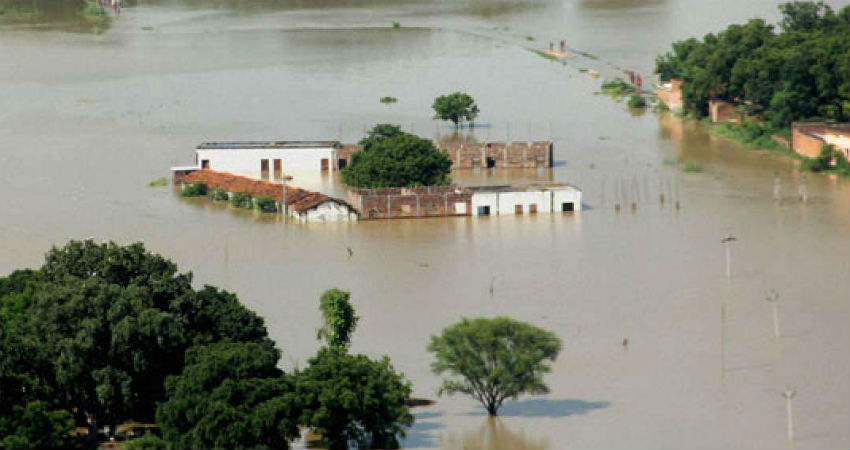
Bihar is flooding, but where did it start? Hint: look north

Source: downtoearth.org.in

You would expect floods to follow heavy rains, but the current flooding of north Bihar preceded extreme rainfall. The trigger for the deluge was the downpour in Nepal.

Bihar shares its northern border with the country, from which a slew of Himalayan rivers run down south. Rising water level in many of those wreaked havoc in 12 districts of north Bihar as floodwater breached embankments, snapped roads, washed away small bridges and damaged standing paddy, maize and jute crops.

On July 11-12, Nepal’s Simara weather station received more than half the 580.2 milimetre rainfall it gets in July normally. The spell totalled 478.40 mm by July 13. 

The next day Nepal opened all 56 sluice gates of the Kosi barrage, with water at alarming levels, releasing three lakh cusecs towards Bihar.

Heavy rainfall ensued in bihar as well, but the sudden rise of water levels in Kosi, Bagmati, Kamka Balan, Gandak, Budhi Gandak and their tributaries was due to an extreme weather event in Nepal, said Vyas, vice-chairman of Bihar State Disaster Management Authority (BSDMA).

The floods have affected more than 2.5 million people of 546 panchayats at 77 blocks in 12 districts, BSDMA officials said.

The state is not new to floods, but it was taken by surprise by the amount of rainfall it received this time and its timing. It usually rains heavily in the state during August, instead of July.

Bihar Chief Minister Nitish Kumar told the Assembly on July 16, 2019 that the state is “fully prepared to deal with” the flash floods. But, everyone else in the state — be it activists or people actually bearing the brunt — feel surprised and unprepared for the unprecedented amount of rainfall.

Everyone living in villages near embankments in Supaul district failed to understand why the water level in river Koshi rose so high in July itself, said Mahendra Yadav, an activist working with flood victims in Koshi region. “Even people in their mid-60s said they had not experienced such a phenomenon in their lifetime,” added Yadav.

North Bihar districts received record-high rainfall during between July 12 and 13, said India Meteorological Department (IMD) officials. East Champaran got 214.92 mm of rainfall, Sitamarhi 154.55 mm and Muzaffatpur 125.15 in those 24 hours. This surpassed a 54-years-old record of heavy rainfall in 24 hours in Bihar.

Then, on July 14, Kishanganj block alone recorded 186.8 mm rainfall within five hours followed by Kochadham block that got 164.2 mm, Thakurganj block 163 mm and Bagadurganj block 162 mm. “Intensity of heavy rainfall was not witnessed before. It caused swollen rivers,” said a disaster management official.

These floods are an example of how climate change would affect lives of people, particularly the poor, Ranjeev, another activist, told Down To Earth.

Now, water resources department officials said water levels in rivers originating in Nepal are decreasing since no heavy rainfall has been recorded in last two days.

Relief and rescue operations are on in flood-affected areas as 26 companies of National Disaster Response Force, State Disaster Response Force and Seema Sashatra Bal have been deployed. Also, 125 boats have been pressed into rescue works.

MORE FLOODING RAINS TO LASH ARARIA, KISHANGANJ, BHAGALPUR, BEGUSARAI, SIWAN AND GAYA

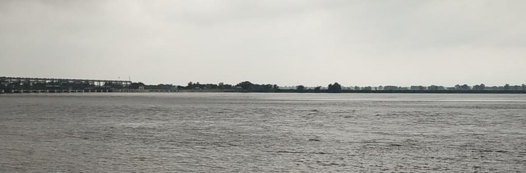
Source: skymetweather.com

Moderate to heavy rains with one or two very heavy spells of Monsoon rains have been lashing the state of Bihar since the last two to three days. These rains have triggered some intense flooding in many districts of the state. The adjoining parts of Nepal too have been reeling under flooding rains for the last many days now. Also, these have resulted in swelling of many rivers.

Places right from Pashchim Champaran to Sitamarhi, including Araria, Kishanganj, Arwal, Aurangabad, Banka, Begusarai, Bhagalpur, Bhojpur, Buxar, Darbhanga, Gaya, Gopalganj, Jamui, Jehanabad, Kaimur (Bhabua), Katihar, Khagaria, and Siwan are experiencing flooding rains at present. Moreover, no relief is expected from such conditions for at least next two to three days. In fact, flooding may worsen in some areas due to continuous heavy downpour.

For the next 48 hours, we expect moderate to heavy with a few very heavy spells of rain and thundershower activities in many parts of Bihar. Thereafter, rains will slightly taper over the region. This is because, the present Trough will start shifting south, thus initiating good rains over the southern districts of Bihar. By this time, rains will reduce in other districts of the state, thus leading to a marginal relief from the flood-like situation.

Skymet has been continuously tracking the weather activities going on over and across the state and thus has been giving weather alerts on a constant basis in order to help the residents, escape this danger. And as more heavy rains are expected to lash the state, localitesare advised to take due precautions.